Berlinfographicsby Berlin Experiences

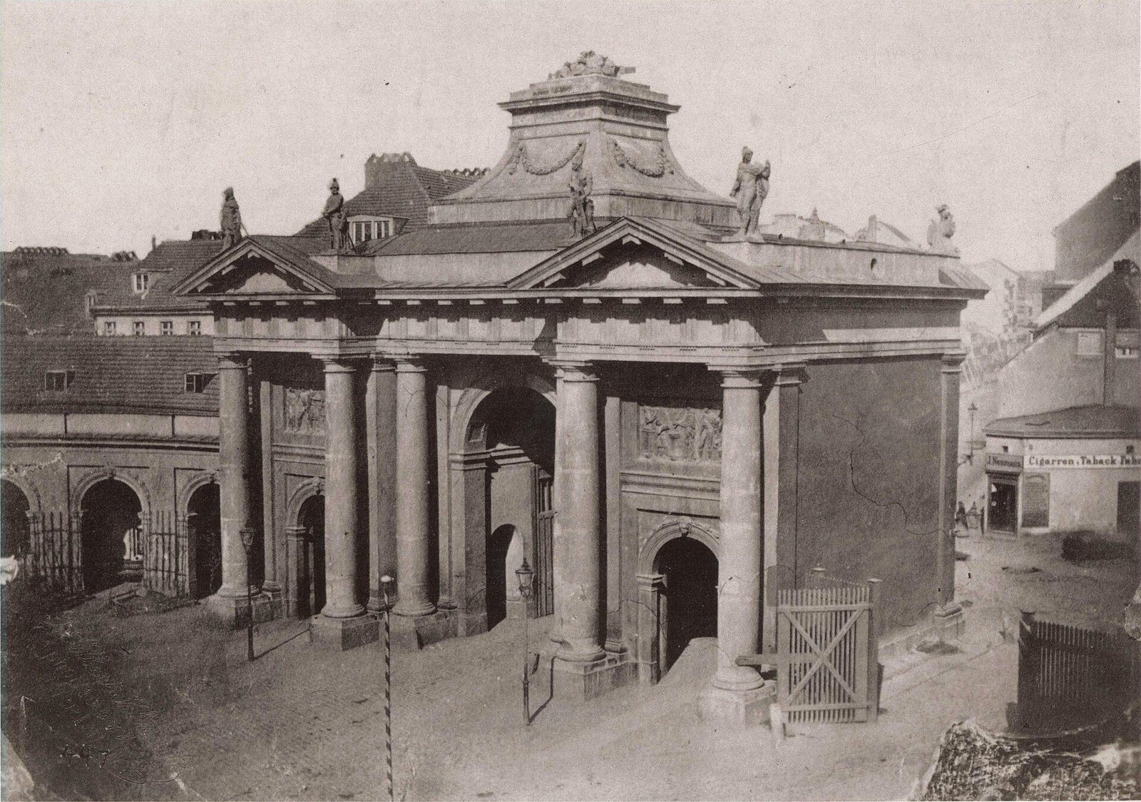
The Oranienburger Tor in 1867, the year the demolition of the wall began. Factory chimneys rise behind it.Friedrich Albert Schwartz, 1867. Wikimedia Commons. Public domain.

The customs wall · Berlin

Berlin’s most famous monument began as a gate in a tax wall. The other 19 gates are gone.

From 1734 a wall almost 16 kilometres long ran round Berlin. It was never meant to stop an army. At its 20 gates officials collected excise on every load brought in, and sentries stopped soldiers deserting.

1734–37
built, under Friedrich Wilhelm I
~16 km
round the city: “almost” that, says the Landesdenkmalamt
20
gates: 17 on land, 3 on the water
1867–70
pulled down, all but the Brandenburger Tor

01Friedrich Wilhelm I

A wall built for the taxman, not against an enemy

Berlin’s medieval wall and its baroque fortress were built for war. The wall that went up between 1734 and 1737, under Friedrich Wilhelm I, the “Soldier King”, had no military purpose at all. It existed to watch trade. At its gates the Akzise was collected: the excise, an indirect tax, on goods brought into the city.

It had a second job. It kept soldiers of the garrison from deserting, and everyone who came in or went out was checked at the gates.

A city walled in to keep its taxes in and its soldiers from running away.

An oil portrait of a young man in a powdered wig and a dark blue coat with a silver star of an order.
Friedrich Wilhelm I of Prussia, the ‘Soldier King’, under whom the wall was built. Portrait by Friedrich Wilhelm Weidemann, about 1720.Friedrich Wilhelm Weidemann, 1720. Wikimedia Commons. Public domain.

02The plan of 1850

20 gates, and no other way in

Hermann Delius’s plan of Berlin of 1850 draws the wall as the line round the city, with a small engraved picture at every gate. On it you can count them: 17 gates on the roads, and 3 on the water. Scroll round the wall.

Berlin in 1850: the wall and its gates

Hermann Delius’s plan of Berlin of 1850. The customs wall runs round the city, with a small engraved picture at each gate. Rings mark the gates as the story moves round the wall.
Land gateWater gatePlan: Delius, 1850
A drawing seen from above of two ornate gate piers in a long wall of boards, with low houses on either side and figures on the road.
The Hallesches Tor, drawn about 1730: two gate piers in a wall of timber boards.Unknown artist, about 1730. Wikimedia Commons. Public domain.

20 gates

One way in on every road

17 land gates and 3 water gates ringed the city. Most were named after the next important town on their road, and many of the names are still in use: Brandenburger Tor, Hallesches Tor, Kottbusser Tor.

A black-and-white photograph of a classical gatehouse with paired columns and a pediment, a heavy wooden door and a cobbled square in front.
The Rosenthaler Tor from the city side, photographed by F. Albert Schwartz in 1865, shortly before it was pulled down.Friedrich Albert Schwartz, 1865. Landesarchiv Berlin. Wikimedia Commons. Public domain.

The north

The Rosenthaler Tor

Everyone who passed was checked at the gates. In the eighteenth century Jews were allowed into Berlin only at set gates. In the north that was the Rosenthaler Tor, which historians at the University of Trier call the only way into the city for Jews.

An architectural sheet with the elevation of an arched gatehouse front, a floor plan and smaller details of ornament.
Karl Friedrich Schinkel’s design for the gatehouses of the Neues Tor (1836): plan, elevation and details, from his Sammlung architektonischer Entwürfe.Karl Friedrich Schinkel, Sammlung architektonischer Entwürfe, sheet 148. Wikimedia Commons. Public domain.

The north-west

A new gate by Schinkel

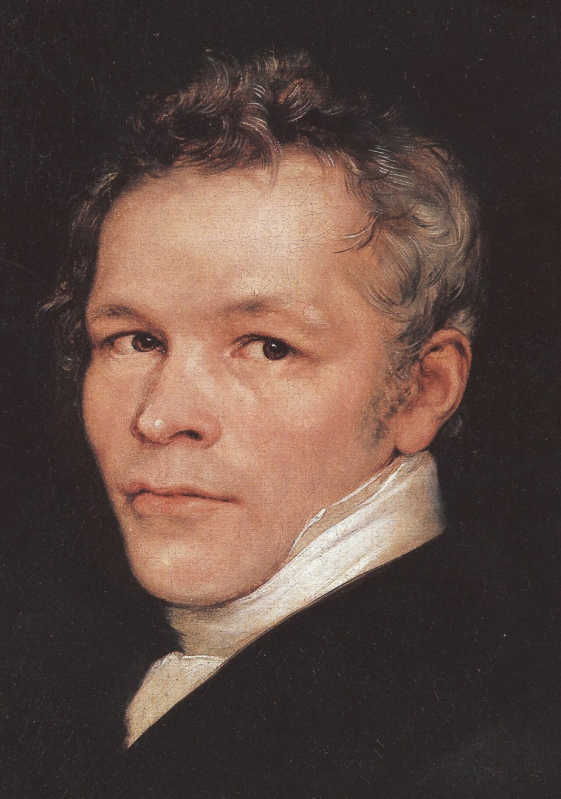
An oil portrait of a man with dark curly hair and a high white collar against a dark background.Karl Friedrich SchinkelCarl Joseph Begas, 1826. Wikimedia Commons. Public domain.

The wall followed the city outward, and gates were added. The Neues Tor of 1836 got a pair of gatehouses designed by Karl Friedrich Schinkel.

A long red-brick bridge with pointed arches, battlements and two tall towers, under a blue sky.
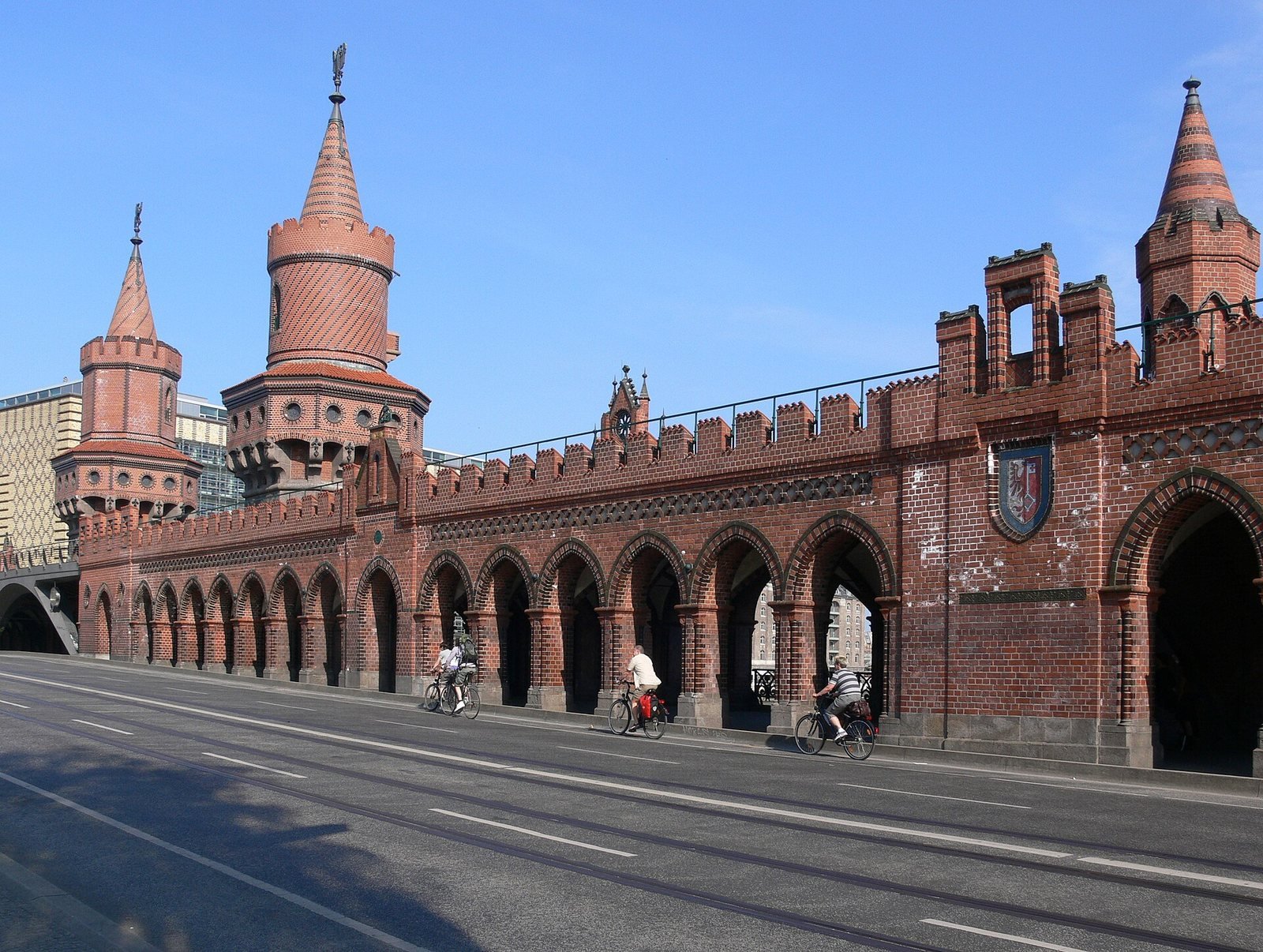
The Oberbaumbrücke today. Here, where the Spree flowed into the city, a barrier of tree trunks closed the river: the Oberbaum, the wall’s eastern end.Photo: Andreas Praefcke, 2009. Wikimedia Commons. CC BY 3.0.

The east

The river shut with tree trunks

Where the Spree crossed the line, no wall could stand. The river was closed instead with barriers of tree trunks: the Oberbaum, where the river flowed into the city, and the Unterbaum, where it flowed out. A wooden bridge stood here by 1724, and the Oberbaumbrücke still carries the name.

A coloured view of a gate between two small temple-fronted buildings, a red coach passing through and figures in the street.
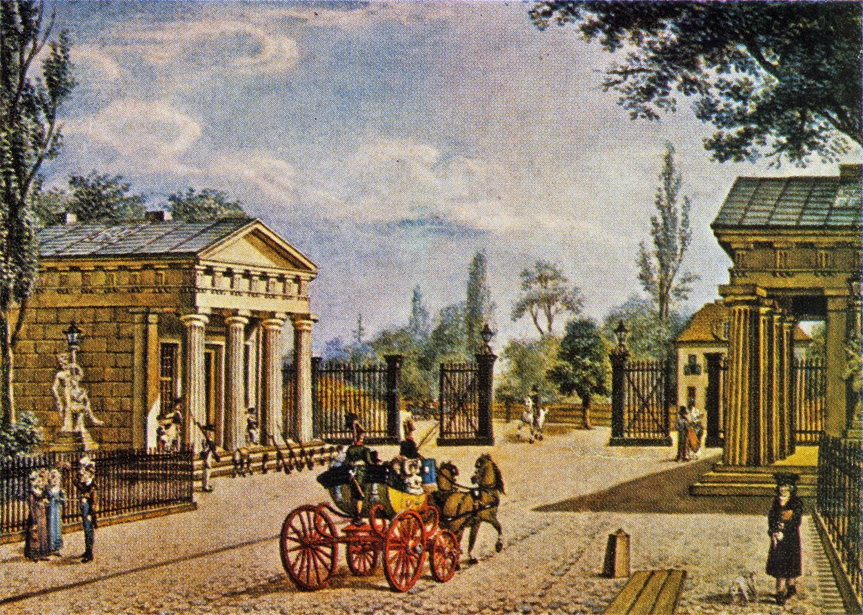
The Potsdamer Tor with Schinkel’s gatehouses, painted by Friedrich August Calau about 1824.Friedrich August Calau, about 1824. Wikimedia Commons. Public domain.

The south-west

The Potsdamer Tor

On the road to the other royal residence, Karl Friedrich Schinkel gave it a pair of temple-fronted gatehouses in the 1820s.

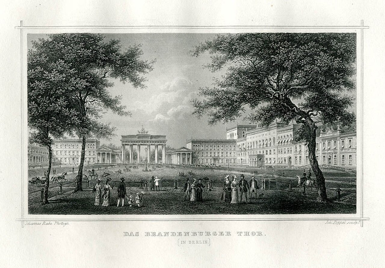
An engraving of the Brandenburg Gate seen across a wide square framed by two large trees, people strolling.
The Brandenburger Tor about 1850, still a gate in the wall. Engraving by Johann Poppel after a photograph by Johannes Rabe.Johann Poppel, engraving after a photograph by Johannes Rabe, about 1850. Wikimedia Commons. Public domain.

The west

The Brandenburger Tor

A pastel portrait of an older man in a powdered wig and an open-necked white shirt.Carl Gotthard LanghansUnknown author. Wikimedia Commons. CC0.

The gate on the road to Brandenburg was rebuilt between 1788 and 1791 to the design of Carl Gotthard Langhans. The Quadriga went on top in 1793. It was still a gate in the wall: the sheds behind its wings ran straight into it.

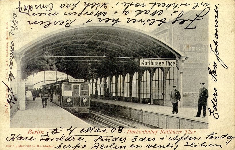
A postcard of an elevated railway station under an arched iron roof, a train at the platform, with handwriting around the picture.
The name outlived the gate: the elevated station Kottbusser Tor on a postcard of 1903.Unknown author, 1903. Wikimedia Commons. Public domain.

June 1867 – March 1870

All pulled down but one

Between June 1867 and March 1870 the wall and its gates were demolished, all except the Brandenburger Tor. The names stayed: the elevated railway built along the line of the wall in Kreuzberg named its stations after the gates.

03Beyond the wall

By 1840, the city was more than twice the size of the walled town

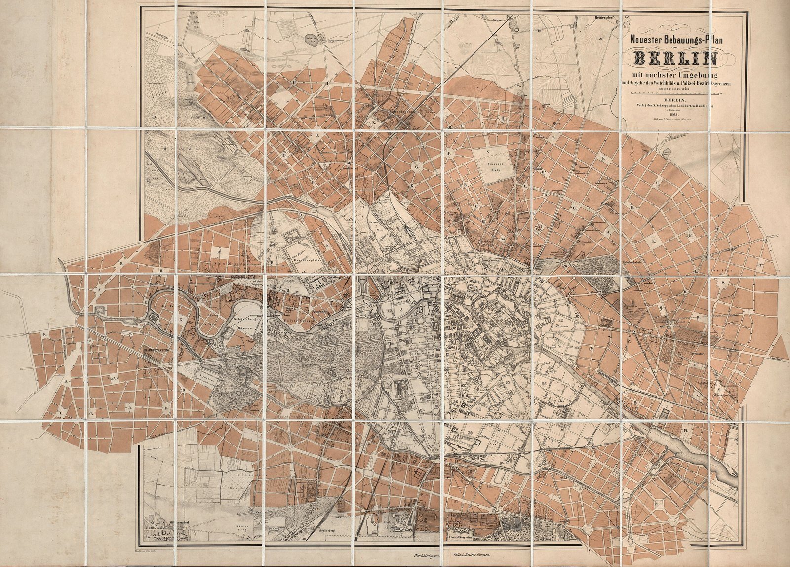
New suburbs grew up outside the gates. By 1840 Berlin covered more than twice the area inside the wall. The plan of 1863 below shows what came next: new districts laid out all round the old town while the wall still stood.

A large folded street plan of Berlin: a pale grey old centre surrounded by a broad ring of pink planned blocks and streets.
The ‘Neuester Bebauungs-Plan von Berlin’ of 1863. The new districts planned around the old city are coloured pink; the wall still stood.C. Birk, 1863. Wikimedia Commons. Public domain.

04What is left

Of almost 16 kilometres, about 40 metres still stand

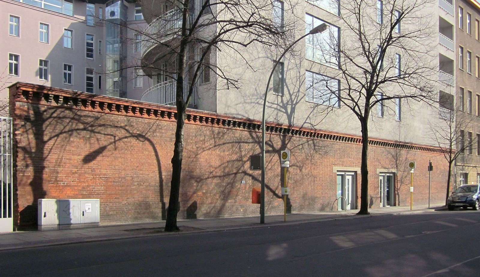
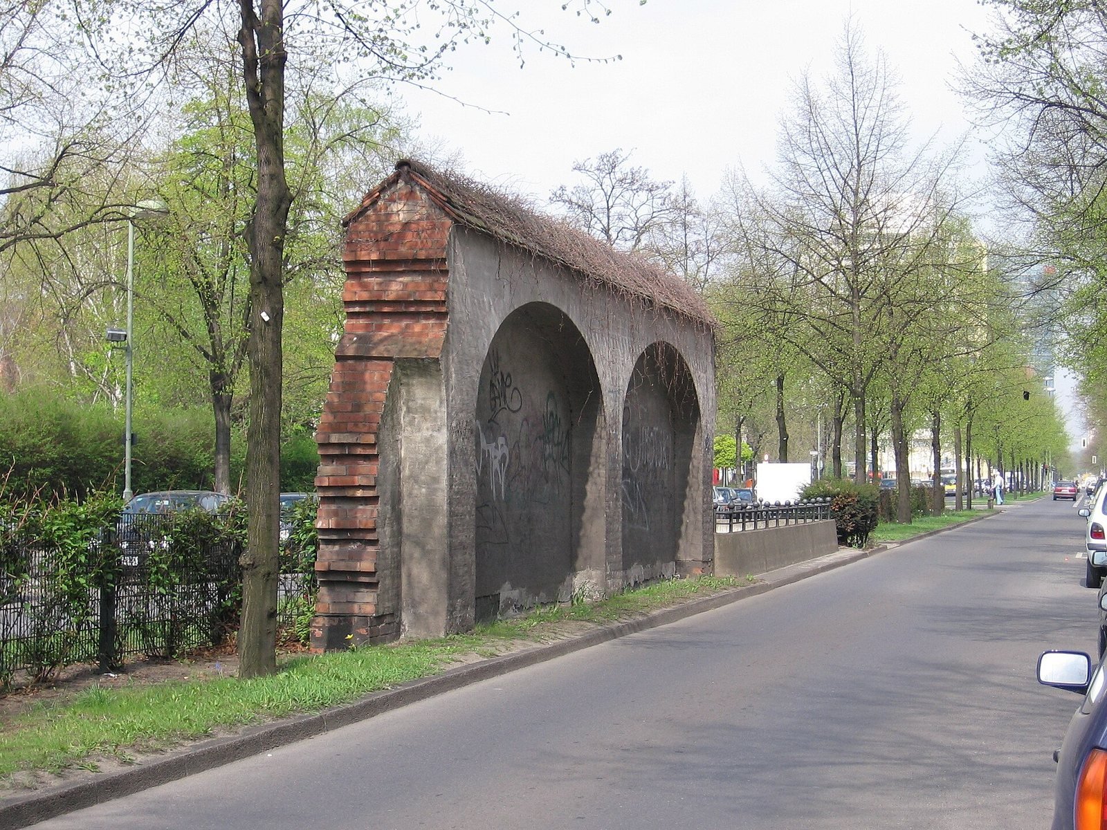
Besides the Brandenburger Tor, about 40 metres of the wall itself, built in 1836, survive in Hannoversche Straße in Mitte, and are a listed monument. In Stresemannstraße in Kreuzberg a stretch was rebuilt in the 1980s on its excavated foundations.

The wall’s length, and what survives of it, on one scale

Both bars use one linear scale. The surviving stretch is drawn at its true width, a sliver about 1/400 of the ring. Length: Landesdenkmalamt Berlin, which gives “almost” this figure.

The Brandenburg Gate with its Quadriga on top, seen from the square in front on a sunny day, with tourists walking.

Brandenburger Tor

The one gate left. Built 1788–1791.

The Brandenburger Tor, 2016: the only one of the wall’s gates still standing.Fred Romero from Paris, France, 2016. Wikimedia Commons. CC BY 2.0.
A long red-brick wall with a dark decorative band along its top, beside a street with trees and a modern building behind.

Hannoversche Straße

About 40 metres of the wall of 1836, listed by the Landesdenkmalamt.

The surviving stretch of the wall, built in 1836, in Hannoversche Straße, Mitte.Jörg Zägel, 2011. Wikimedia Commons. CC BY-SA 3.0.
A short freestanding brick wall with three tall arches on a grass verge beside a tree-lined road.

Stresemannstraße

Rebuilt in the 1980s where the wall’s foundations were dug up.

A section of the wall rebuilt in the 1980s on its excavated foundations, Stresemannstraße, Kreuzberg.Schlesinger, 2006. Wikimedia Commons. CC BY-SA 3.0.

Berlin’s wall before the Wall was built to count carts, not to keep out armies.

The tax gate on the road to Brandenburg is the only part of it the city kept.

Press & citation

Use this Berlinfographic

Free to publish under CC BY 4.0 — in print, online, on Wikipedia and in teaching, commercially or not — with credit to Berlinfographics and a link to this page.

Berlin’s Customs Wall, 1734–1870: ready-to-use landscape image

Ready-to-use image

The infographic as one image: headline, key figures, chart, sources and credit, 2,400 × 1,350 px PNG. Please use it unedited.

Download landscape (PNG)
Berlin’s Customs Wall, 1734–1870: square version

Square format

A 1:1 version for social media and narrow columns, 1,800 × 1,800 px.

Download square (PNG)
Berlin’s Customs Wall, 1734–1870: portrait version

Portrait 4:5

For Instagram and LinkedIn feeds, 1,620 × 2,025 px.

Download portrait (PNG)

Credit line

Berlinfographics (berlinfographics.com), CC BY 4.0

Citation

Berlinfographics (2026). “Berlin’s Customs Wall, 1734–1870”. Berlin Experiences. https://berlinfographics.com/berlin-customs-wall/

Wikipedia

{{cite web |title=Berlin’s Customs Wall, 1734–1870 |url=https://berlinfographics.com/berlin-customs-wall/ |website=Berlinfographics |publisher=Berlin Experiences |date=2026-11-09 |access-date=2026-11-09}}