Berlinfographicsby Berlin Experiences

Berlin and Cölln from the air, as Johann Bernhard Schultz drew them in 1688. The towns of this story lie inside the later fortifications.Image: Johann Bernhard Schultz, 1688. Wikimedia Commons. Public domain.

Berlin and Cölln

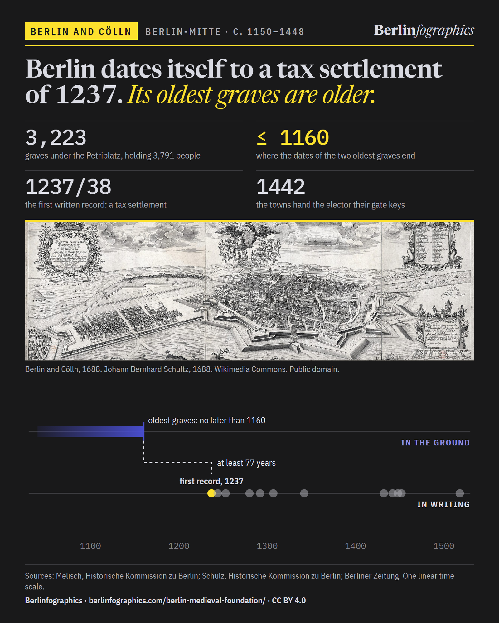
Berlin dates itself to a tax settlement of 1237. Its oldest graves are older.

Under Cölln’s parish church, radiocarbon puts the two oldest burials no later than 1160. The twin towns on the Spree grew rich, joined forces twice, and in 1442 handed their keys to a Hohenzollern who built a castle beside them.

3,223
graves under the Petriplatz, holding 3,791 people
≤ 1160
where the radiocarbon dates of the two oldest graves end
1237/38
the first written record: a tax settlement, not a founding charter
6,000–7,000
inhabitants of Berlin-Cölln in the 14th century
01The Petriplatz, Cölln

No one wrote down when Berlin began

There is no founding charter for Berlin or for Cölln. Perhaps one was destroyed; perhaps none was ever written. The Chronicle of the Margraves of Brandenburg, written around 1280, says only that the margraves Johann I and Otto III built Berlin, among other towns.

So the answer had to come out of the ground. From 2007 archaeologists dug the Petriplatz, the heart of medieval Cölln. They found the foundations of five successive churches, the Latin school, wooden cellars and 3,223 graves holding 3,791 people. The oldest timber, from an oak well, was felled around 1203.

Cölln was planned: the streets came first, and the plots were measured off them.

Radiocarbon gives a span, not a year. The two oldest grave dates fall in a flat stretch of the calibration curve between 1040 and 1160: the people in them lived no later than 1160, and may be older. The excavator, Claudia Maria Melisch, dates the settlement to “about 1150” and warns against reading the dates as exact years.

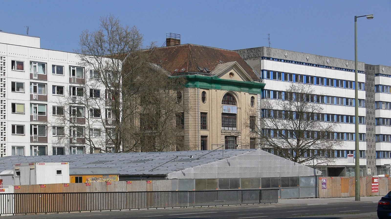
A long, low white tent beside a busy road, with office blocks and a domed former department store behind it.
The excavation tent over the Petriplatz on Gertraudenstraße, 2009. Under it lay the foundations of Cölln’s parish church and its churchyard.Photo: Andreas Praefcke, 2009. Wikimedia Commons. CC BY 3.0.
Inside a scaffolded hall, sandy excavation trenches expose rough stone foundation walls; tables and stacks of white boxes stand on a platform.
Inside the tent, 2009: the foundations of the Petrikirche, with finds tables and boxes along the trench.Photo: Andre_de, 2009. Wikimedia Commons. CC BY-SA 3.0.
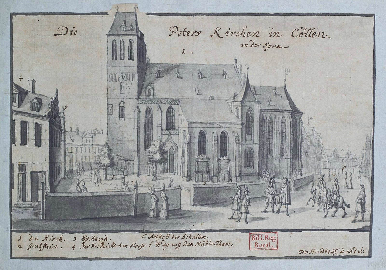
A pen drawing of a tall Gothic church with a square tower above a cobbled square with figures and a carriage.
Cölln’s parish church, St Peter, drawn by Johann Stridbeck in 1690: the Gothic church that stood on the site the archaeologists later dug.Image: Johann Stridbeck the Younger, 1690. Wikimedia Commons. Public domain.

Every dated record, on one time scale

Every dated record of the twin towns on one linear time scale, from the radiocarbon range of the oldest graves to the towns' exit from the Hanse, with the ruling dynasties beneath.

in the groundin writinga building · one linear scale; “about” dates drawn open

Excavation trenches with stone foundations inside a scaffolded tent, with work tables beyond.
Under the excavation tent on the Petriplatz, 2009.Photo: Andre_de, 2009. Wikimedia Commons. CC BY-SA 3.0.

Petriplatz · excavated from 2007

The graves are older than the record

Radiocarbon puts the two oldest of 3,223 graves no later than 1160: at least 77 years before any document names the town. Settlement began around 1150.

A stepped brick Gothic gable rising above lower whitewashed and brick walls of a cathedral.
Brandenburg cathedral, whose archive holds the parchment.Photo: Sebastian Wallroth, 2015. Wikimedia Commons. CC BY 4.0.

1237, written down 1238

The first record is a tax settlement

In 1237, at Brandenburg, the margraves and the bishop settled a tax dispute. One witness was “Symeon plebanus de Colonia”, Cölln’s priest. The record, written in 1238, is no founding charter.

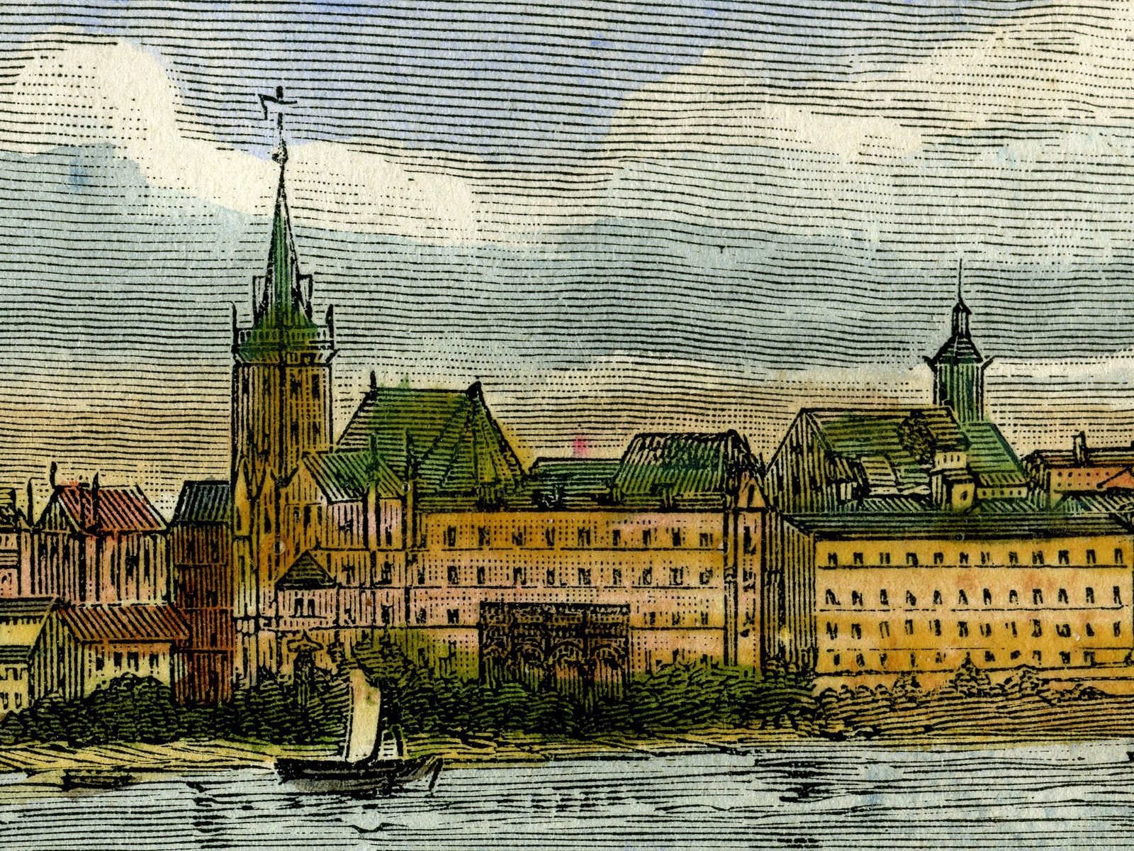
A coloured engraving of a riverside town with a tall church tower and a long gabled town hall, a sailing boat on the water.
Frankfurt (Oder), given Berlin’s law, in an engraving of 1860.Image: Victor Adolphe Malte-Brun, 1860. Wikimedia Commons. Public domain.

1244 · 1253

Seven years later, Berlin

Symeon reappears in 1244 as provost of Berlin: the first record of the second town. By 1253 Berlin’s own town law was being given to Frankfurt (Oder).

A black-and-white photograph of a stone arched bridge across a river, with rafts in the foreground and tall buildings beyond.
The Lange Brücke in 1889, the site of the joint town hall.Photo: Hermann Rückwardt, 1889. Wikimedia Commons. Public domain.

1307 · 1342

Two towns, one council

In 1307 Berlin and Cölln formed a union to defend their rights against the margrave. A joint town hall on the Lange Brücke, the bridge between them, is first referred to in 1342.

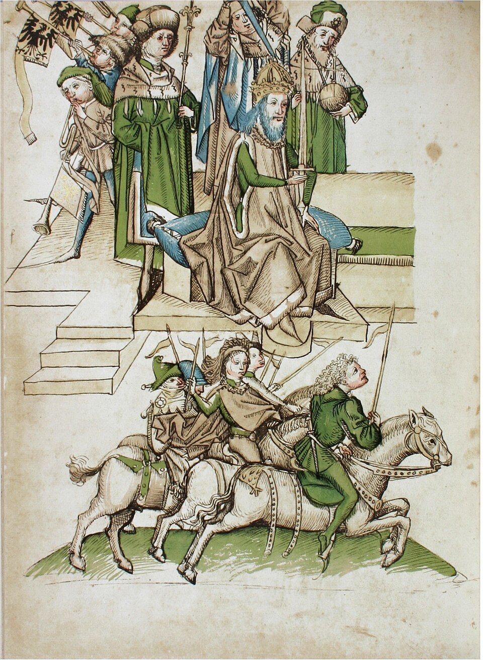
A coloured manuscript drawing of a crowned emperor on a throne handing a banner to a kneeling nobleman among courtiers.
Burgrave Friedrich is enfeoffed with the Mark at Constance.Image: Ulrich Richental, 1464. Wikimedia Commons. Public domain.

1320–1411

Four dynasties in a century

The Ascanians died out in 1320. Wittelsbachs ruled from 1323 to 1373, Luxembourgs until 1411, when the Hohenzollerns were named its administrators. The towns, 6,000–7,000 strong, often led the Mark’s town leagues.

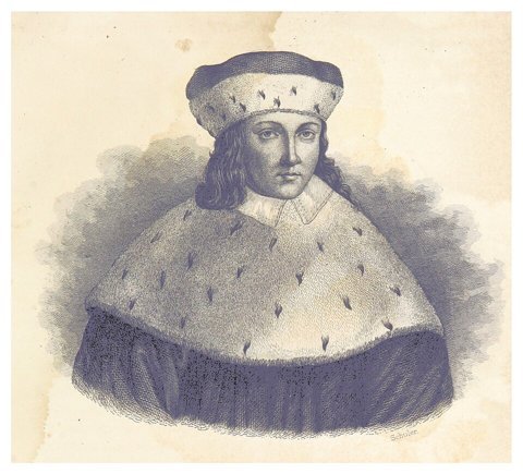
Engraved bust of a man in an ermine cap and ermine cape.
Elector Friedrich II, in an engraving of 1836.Image: Unknown engraver, in Fischer, 1836. Wikimedia Commons. Public domain.

1432 · 29 August 1442

The keys of the four gates

In 1432 the towns agreed to merge. In 1442 Friedrich II took the keys of the four gates and undid the union. On 29 August the towns ceded a castle site, their town hall and their high court.

A coloured 17th-century town plan: a large walled town shaded red on one bank of a river and a smaller one shaded yellow on an island, with a palace and formal garden at the island's tip.
Memhardt’s plan of 1652: the castle grounds at the island’s northern tip, beside Cölln.Image: Johann Gregor Memhardt, 1652 (1888 reprint). Wikimedia Commons. Public domain.

31 July 1443 – spring 1451

A castle beside Cölln

Friedrich laid the foundation stone on 31 July 1443, on the Spree island beside Cölln. Finished in the spring of 1451, it became his main residence.

A pen drawing of a broad square with a long gabled Renaissance palace and arcades, horsemen and a carriage in front.
The Renaissance palace that later replaced the castle, drawn in 1690.Image: Johann Stridbeck the Younger, 1690. Wikimedia Commons. Public domain.

1447/48 · 18 June 1448

The Unwille: the citizens flood the site

At the turn of 1447/48 citizens flooded the building site, drove out the elector’s officials and destroyed his documents. On 18 June 1448 they submitted again, and lost their mills and tolls too.

An early photograph of a brick town hall with a row of slender turrets and round openings above an arcade.
Lübeck town hall, photographed in 1847.Photo: Joseph Wilhelm Pero, 1847. Wikimedia Commons. Public domain.

1452 · 1518

The Hanse never came

The towns had begged their Hanse allies for help, in vain. In 1452 they wrote bitterly to Lübeck that they were leaving the league; the exit was completed only in 1518.

02Two towns, one river

Grain, rivers and a law worth copying

The towns grew rich on trade. Rich and poorer citizens alike shipped their grain, “siligo que dicitur de Berlyn”, to Hamburg and Flanders and sold it at a profit. The Spree, Havel and Elbe led to Hamburg and the North Sea; a short land route over the Oder led to Stettin and the Baltic.

By the 14th century Berlin-Cölln had 6,000–7,000 inhabitants and led the Mark politically. No picture of the medieval towns survives: the engraving here is how an artist imagined them in the nineteenth century.

A 19th-century engraving of two small walled towns facing each other across a river, with churches and a bridge.
“Berlin and Cölln around 1250”, as an artist imagined them in 1882. The picture is Wilhelmine invention: no view of the medieval towns survives.Photo: F. Wittig, 1882. Wikimedia Commons. Public domain.

031442–1518

Most was lost in 1442, not in 1448

The famous defeat came in 1448, but the decisive surrender came six years earlier. According to a later source, Friedrich appeared before the town with 600 horsemen and had the gates opened.

The town council went on, but the elector now confirmed its elections. Even the Hanse exit took decades: declared in 1452, completed in 1518.

What the towns gave up, and when

Schulz: the 1442 treaty and the 1448 submission; the Hanse exit. Filled dots: given up to the elector. Open: the Hanse. One linear scale.

04The town seal

The town seal shows who won

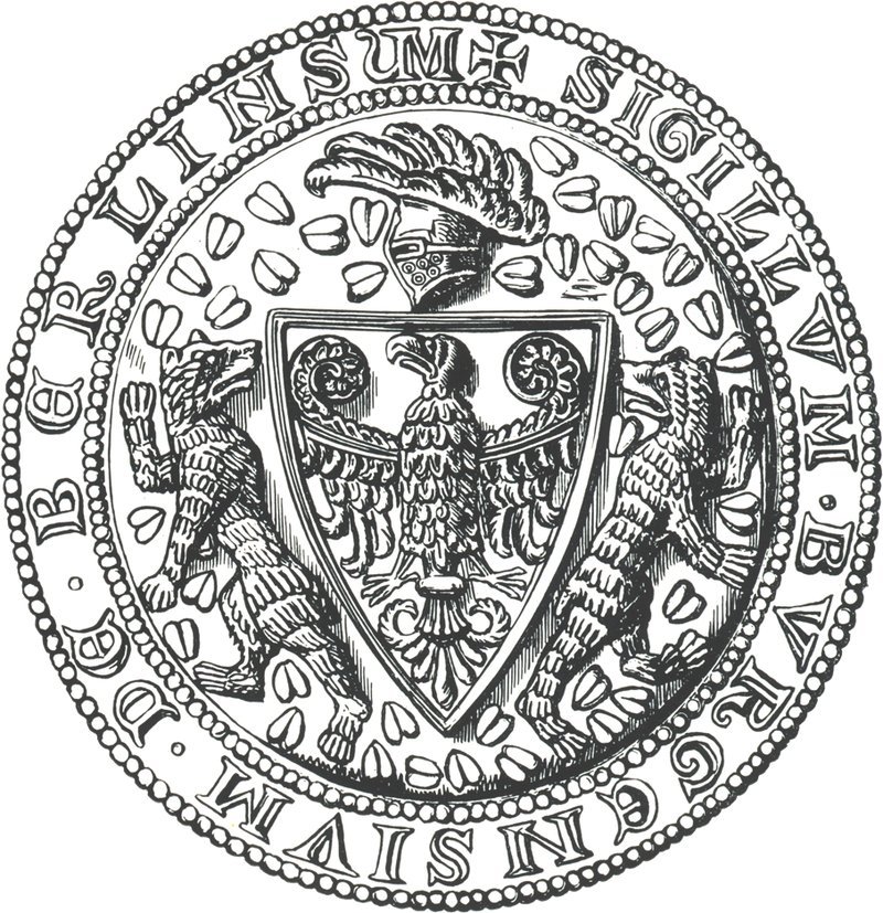
Berlin’s oldest known seals, from 1253, carry the margrave’s eagle. The second seal, of 1280, adds two bears holding the eagle’s shield. After 1448 the seal was recut: the eagle now stood on the bear’s back, wings spread, talons out, and the bear hung out its tongue under the weight.

A round wax seal drawn in black and white: an eagle in an arched gateway flanked by towers, with a Latin legend round the rim.
1253Berlin’s oldest known town seal, 1253: the Brandenburg eagle beneath a gate and towers.Image: Seal of Berlin, 1253. Scan by Jwnabd. Wikimedia Commons. Public domain.
A round seal drawing: a shield with an eagle, held between two rearing bears, under a crested helmet.
1280The second town seal, 1280: two bears, for the first time, flanking the eagle shield.Image: Seal of Berlin, 1280. Scan by Jwnabd. Wikimedia Commons. Public domain.
A round seal drawing: inside a square shield an eagle with spread wings stands on the back of a walking bear.
after 1448A Berlin town seal of the type used after the Unwille (Commons dates it 1460): the eagle stands on the bear’s back.Image: Seal of Berlin, 1460. Scan by Jwnabd. Wikimedia Commons. Public domain.

Each seal’s date on one linear scale. The third type is dated “after” the Unwille: the source gives no exact year.

05Berlin-Mitte today

Two medieval churches still stand

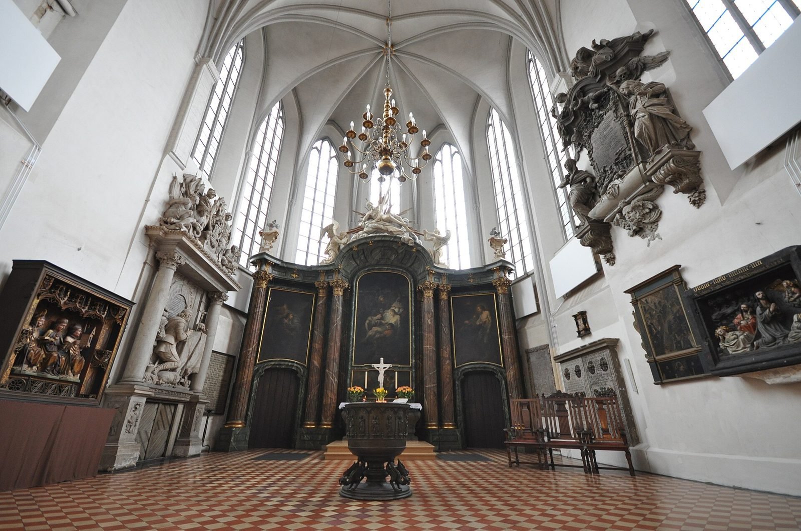
The Nikolaikirche, Berlin’s parish church, is the oldest: its fieldstone tower base survives from the first church; the rest was destroyed in 1945 and rebuilt in the 1980s. The Marienkirche, first documented in 1292, is still a parish church.

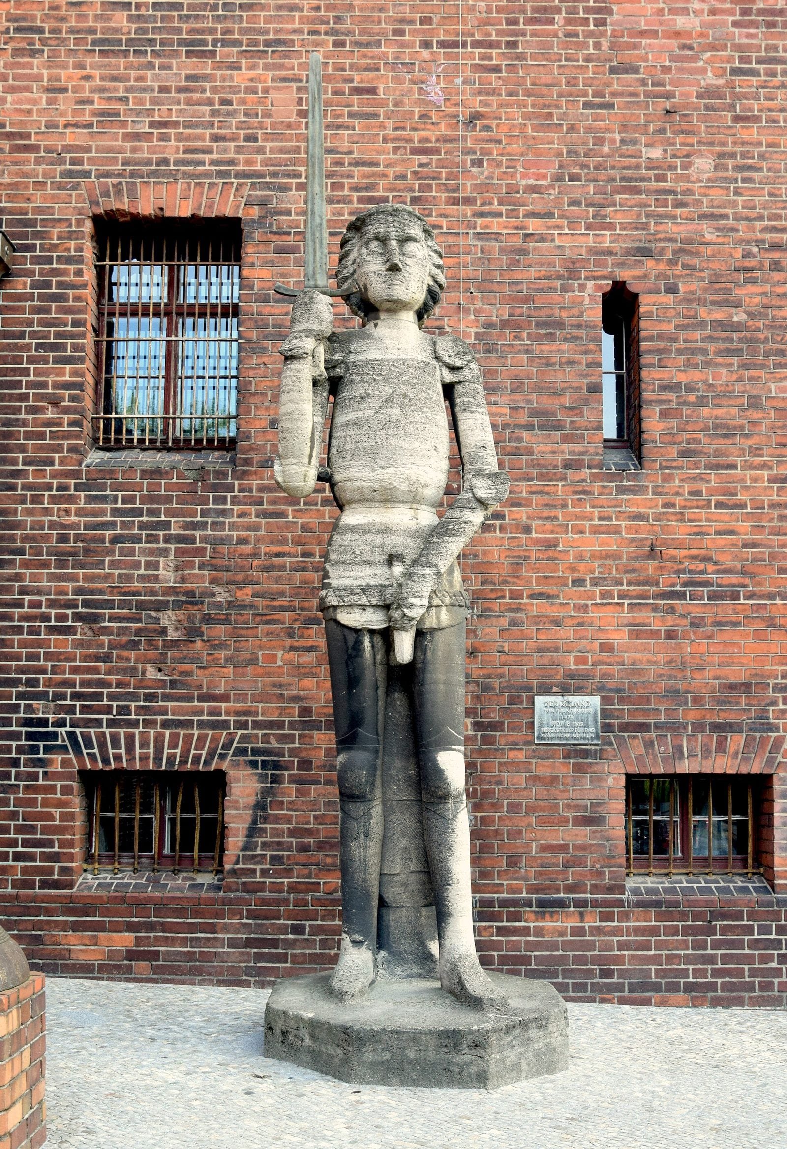
Berlin’s rise as a capital came only some 250 years later, from about 1700. The nineteenth century turned the towns’ defeat into legend: in Willibald Alexis’s novel of 1840, the elector smashes Berlin’s Roland, symbol of the citizens’ pride, and throws it in the Spree. A copy of another town’s Roland was set up in front of the Märkisches Museum in 1905.

A brick Gothic church with twin pointed spires above a small square with bare trees and cobbles.
The Nikolaikirche today. Its fieldstone tower base survives from the first church; the rest was destroyed in 1945 and rebuilt in the 1980s.Photo: Jorge Láscar from Australia, 2009. Wikimedia Commons. CC BY 2.0.
A whitewashed Gothic church interior with tall pointed windows, a baroque altar and carved epitaphs on the walls.
The nave of the Marienkirche, first documented in 1292. It is still a parish church.Photo: Jorge Láscar from Australia, 2009. Wikimedia Commons. CC BY 2.0.
A grey stone statue of an armoured knight holding an upright sword, in front of a red-brick wall.
The Roland copy put up in front of the Märkisches Museum in 1905, after the 1474 statue in Brandenburg’s Neustadt.Photo: Singlespeedfahrer, 2022. Wikimedia Commons. CC0.

What came next: the Hohenzollerns, five titles in five centuries, from the enfeoffment at Constance on 18 April 1417. And the museum that built Berlin a Middle Ages: the Märkisches Museum.

The first page that names Cölln records a tax dispute. The town was already old.

Press & citation

Use this Berlinfographic

Free to publish under CC BY 4.0 — in print, online, on Wikipedia and in teaching, commercially or not — with credit to Berlinfographics and a link to this page.

Berlin and Cölln, the twin towns: ready-to-use landscape image

Ready-to-use image

The infographic as one image: headline, key figures, chart, sources and credit, 2,400 × 1,350 px PNG. Please use it unedited.

Download landscape (PNG)
Berlin and Cölln, the twin towns: square version

Square format

A 1:1 version for social media and narrow columns, 1,800 × 1,800 px.

Download square (PNG)
Berlin and Cölln, the twin towns: portrait version

Portrait 4:5

For Instagram and LinkedIn feeds, 1,620 × 2,025 px.

Download portrait (PNG)

Credit line

Berlinfographics (berlinfographics.com), CC BY 4.0

Citation

Berlinfographics (2026). “Berlin and Cölln, the twin towns”. Berlin Experiences. https://berlinfographics.com/berlin-medieval-foundation/

Wikipedia

{{cite web |title=Berlin and Cölln, the twin towns |url=https://berlinfographics.com/berlin-medieval-foundation/ |website=Berlinfographics |publisher=Berlin Experiences |date=2026-11-09 |access-date=2026-11-09}}