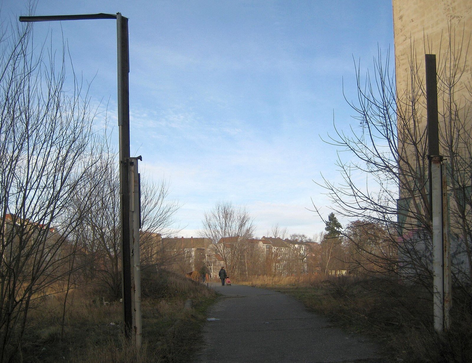
The border stripCold War Berlin · East to West
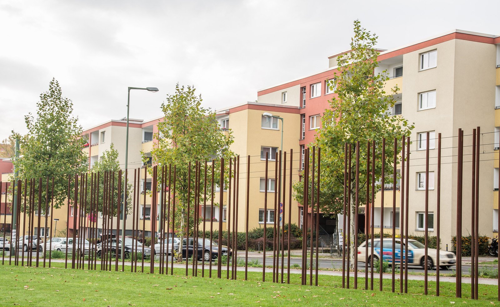
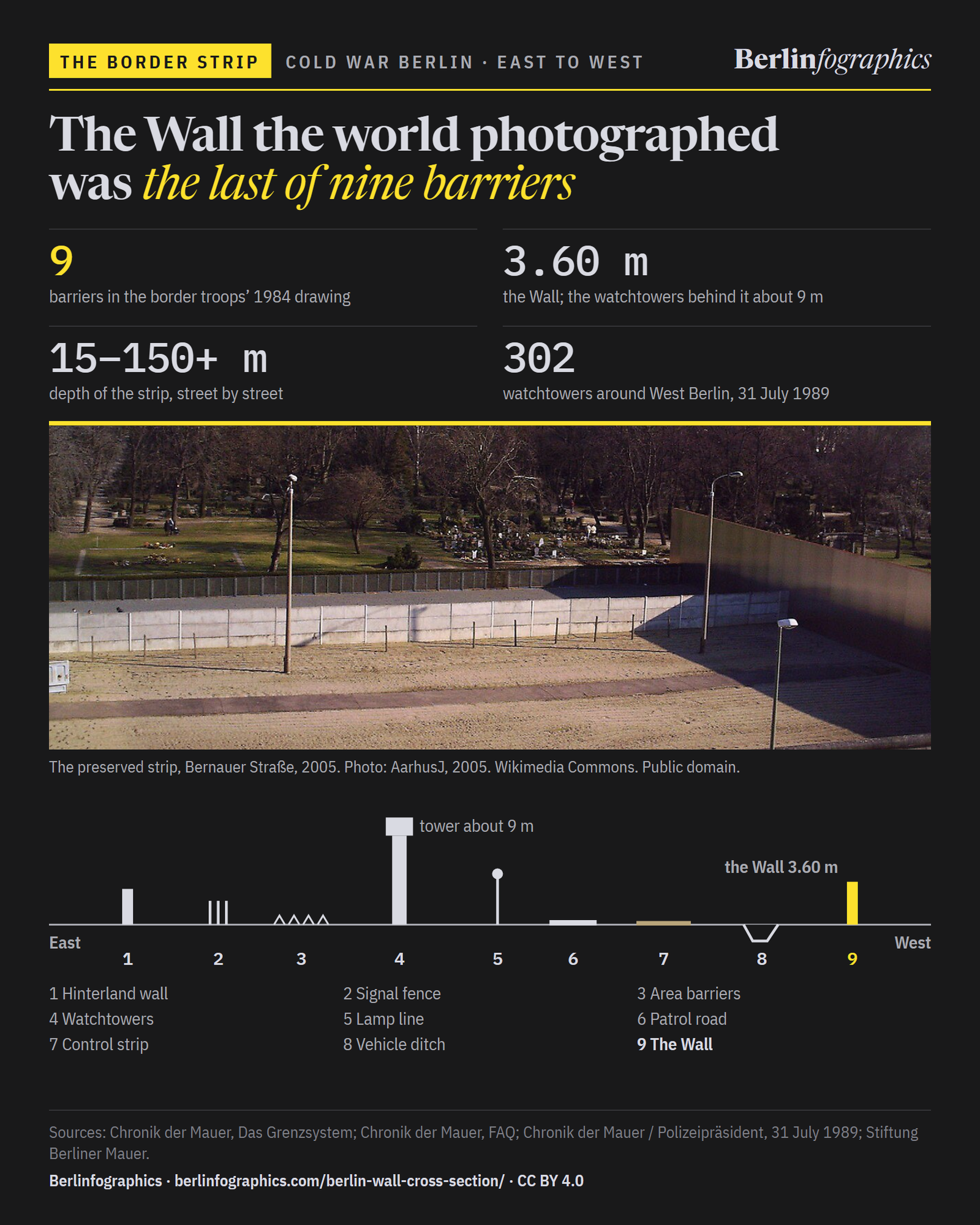
From West Berlin it was one concrete wall, 3.60 m high. From the East, as the border troops drew it in 1984, it was the 9th barrier of a strip between 15 and more than 150 metres deep — and all of it stood on East German ground.
Scroll to cross it, barrier by barrier
The preserved border strip at the Berlin Wall Memorial, Bernauer Straße, seen from the memorial’s tower in March 2005: the Wall in the foreground, the sand of the strip and its lamps, the hinterland wall beyond, and East Berlin with its television tower on the skyline.AarhusJ, 2005. Wikimedia Commons. Public domain.
01Two sides
The Wall the world photographed was only the border’s face to the West. The death strip behind it stood on the East’s own ground, built to stop its own people.
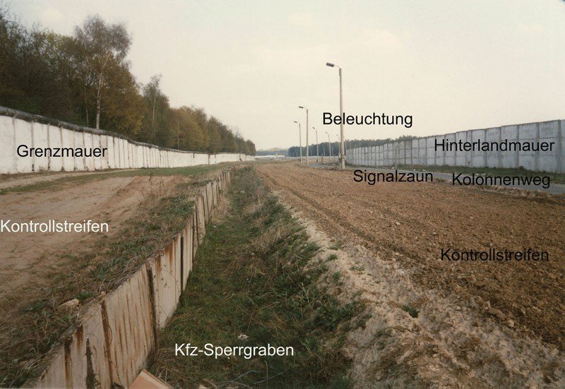
The border troops’ own drawing of the strip facing West Berlin, captioned 1984 by the Chronik der Mauer, lists 9 elements. Read from the East — the direction of an escape — the Wall is the last of them. The number and order of barriers varied from place to place and year to year.

02The crossing
Heights to scale where the sources give one (hinterland wall, signal fence, tower, Wall); lamps, road and ditch are symbols. Barriers are spaced evenly: the strip’s depth varied too much to draw one width.
1984 · the drawing
The standard layout of the border strip facing West Berlin as the GDR border troops drew it in 1984. The number and order of barriers varied from place to place and year to year. The drawing (BA-MA GTÜ AZN 17790) labels its elements West to East; here they are read East to West, the way someone escaping would meet them.
Source: Chronik der Mauer, Das Grenzsystem
Barrier 1 of 9
Hinterlandmauer
Sealed the strip off from East Berlin. Its inner face was painted white, so a figure showed up against it.
Source: Chronik der Mauer, Das Grenzsystem · Chronik der Mauer, FAQ · Stiftung Berliner Mauer
Barrier 2 of 9
Grenzsignalzaun
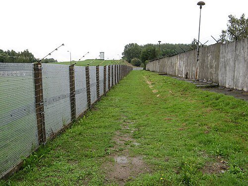
Touch it and an alarm went off in the tower. Where the view was blocked, dogs ran on a line beside it.
Source: Chronik der Mauer, Das Grenzsystem · Chronik der Mauer, FAQ · Wikipedia (de), Berliner Mauer
Barrier 3 of 9
Flächensperren
Fields of metal gratings and obstacles. Most were cleared out of the strip during the 1980s.
Source: Chronik der Mauer, Das Grenzsystem · Stiftung Berliner Mauer
Barrier 4 of 9
Beobachtungstürme
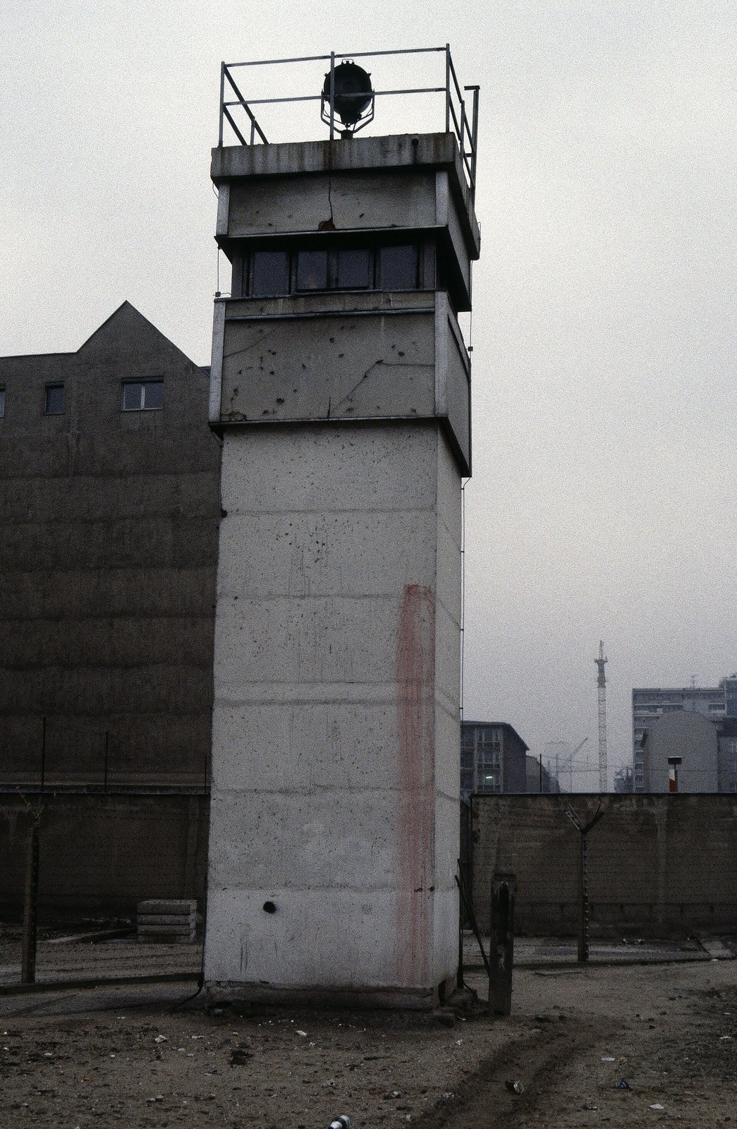
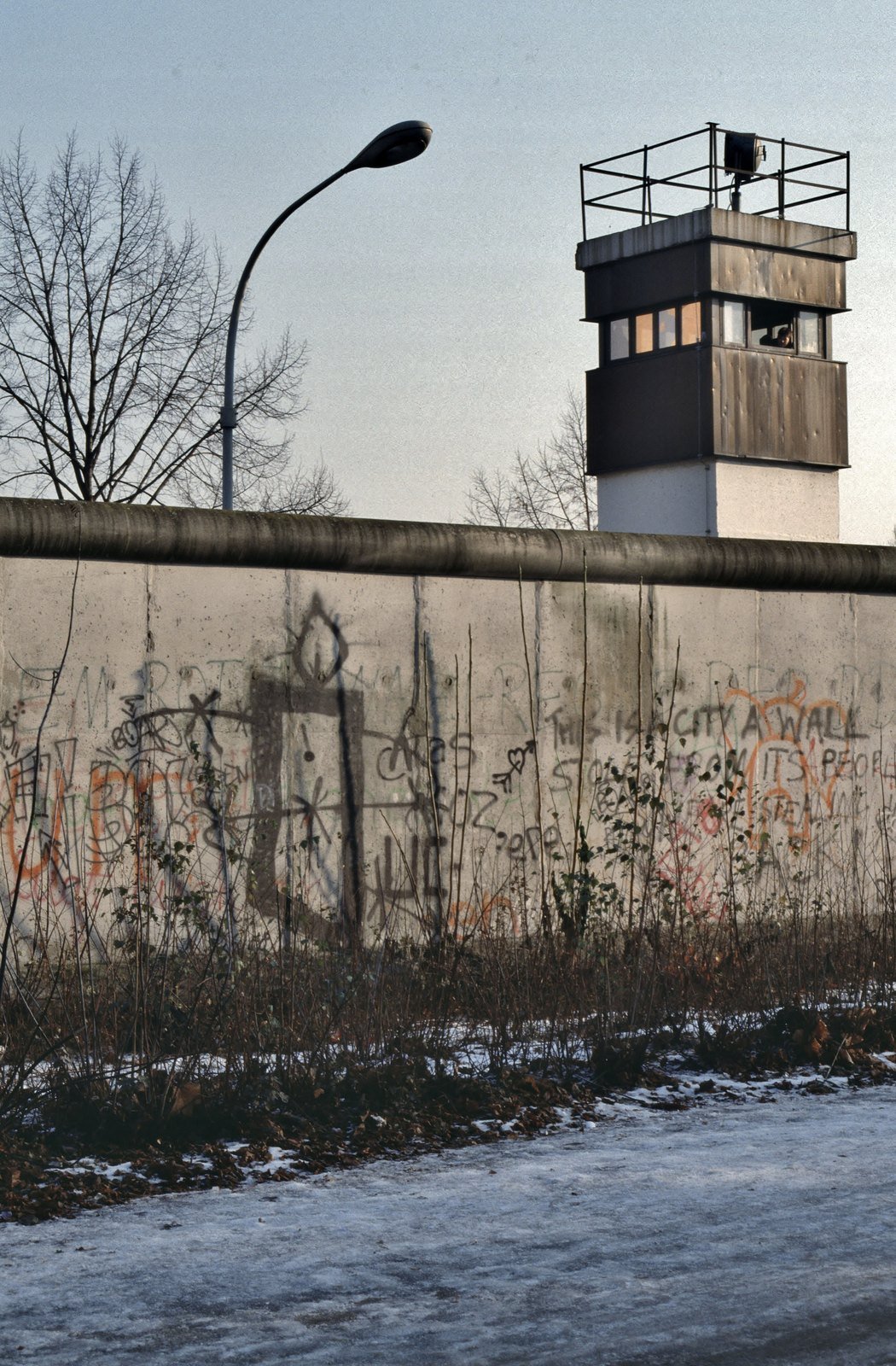
About 250 m apart. Guards worked in pairs, armed with Kalashnikovs.
Source: Chronik der Mauer, Das Grenzsystem · Wikipedia (de), Beobachtungsturm · Stiftung Berliner Mauer · Chronik der Mauer, FAQ
Barrier 5 of 9
Lichttrasse
Lit the strip as bright as day all night.
Source: Chronik der Mauer, Das Grenzsystem · Chronik der Mauer, FAQ · Stiftung Berliner Mauer
Barrier 6 of 9
Kolonnenweg
Carried the relief guards and brought up reinforcements.
Source: Chronik der Mauer, Das Grenzsystem · Wikipedia (de), Berliner Mauer
Barrier 7 of 9
Kontrollstreifen
Kept freshly harrowed so that every footprint showed. Even guards were not to step on it without reason.
Source: Chronik der Mauer, Das Grenzsystem · Wikipedia (de), Berliner Mauer
Barrier 8 of 9
Kfz-Sperrgraben
The last obstacle before the Wall, dug to stop vehicles ramming through.
Source: Chronik der Mauer, Das Grenzsystem · Chronik der Mauer, FAQ
Barrier 9 of 9
Grenzmauer 75
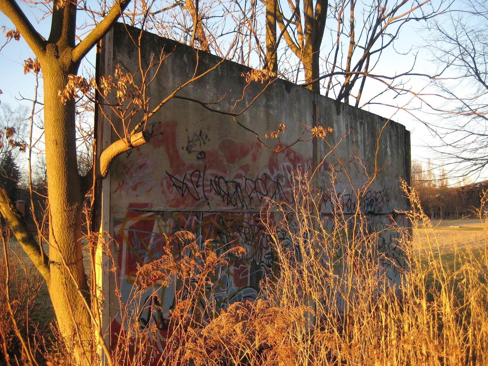
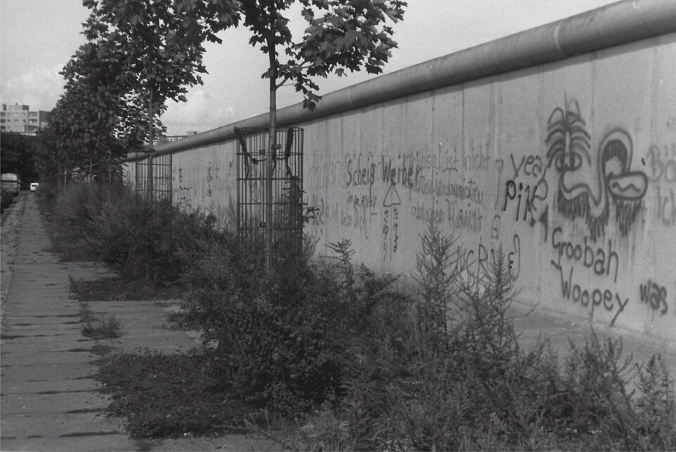
Precast concrete segments 1.20 m wide, with a round pipe on top that gave no grip. This was the Wall West Berlin saw.
Source: Chronik der Mauer, Das Grenzsystem · Chronik der Mauer, FAQ · Wikipedia (de), Berliner Mauer
The depth
The whole strip, hinterland wall to Wall, ran between 15 and more than 150 metres deep, depending on the street, the river and the buildings it cut through. At its deepest it was at least ten times the shallowest.
Source: Chronik der Mauer, FAQ
The border line
The whole strip lay on GDR territory, which ran on a few metres past the Wall. A West Berliner standing at the Wall was still a few steps short of the actual border.
Source: Wikipedia (de), Berliner Mauer
From the West
From the western side only the last element was visible: Grenzmauer 75, 3.60 m high — less than half the height of the watchtowers behind it. Eight barriers stood on the far side.
Source: Chronik der Mauer, Das Grenzsystem · Chronik der Mauer, FAQ · Wikipedia (de), Berliner Mauer · Wikipedia (de), Beobachtungsturm · Stiftung Berliner Mauer

03The order
The watchtowers stood about 250 m apart. Guards worked in pairs, armed with Kalashnikovs. The order read out to guards before every shift into the 1980s.
“Grenzverletzer sind festzunehmen oder zu vernichten”
“Border violators are to be arrested or annihilated.”
04The count
The West Berlin police kept count. Their table of 31 July 1989 lists what stood along the 155 km around the western half of the city. The border troops’ own figure for the length was 156.4 km.
Lengths, 31 July 1989
Source: Chronik der Mauer: Die Berliner Mauer (Stand 31. Juli 1989), source Der Polizeipräsident von Berlin
05Those who crossed

Unlike the border with West Germany, the Berlin Wall had no mines.

The Wall the world photographed was only the border’s face to the West. The death strip behind it stood on the East’s own ground, built to stop its own people.

Press & citation
Free to publish under CC BY 4.0 — in print, online, on Wikipedia and in teaching, commercially or not — with credit to Berlinfographics and a link to this page.
Ready-to-use image
The infographic as one image: headline, key figures, chart, sources and credit, 2,400 × 1,350 px PNG. Please use it unedited.
Download landscape (PNG)
Square format
A 1:1 version for social media and narrow columns, 1,800 × 1,800 px.
Download square (PNG)
Portrait 4:5
For Instagram and LinkedIn feeds, 1,620 × 2,025 px.
Download portrait (PNG)Credit line
Berlinfographics (berlinfographics.com), CC BY 4.0
Citation
Berlinfographics (2026). “The Berlin border strip in cross-section”. Berlin Experiences. https://berlinfographics.com/berlin-wall-cross-section/
Wikipedia
{{cite web |title=The Berlin border strip in cross-section |url=https://berlinfographics.com/berlin-wall-cross-section/ |website=Berlinfographics |publisher=Berlin Experiences |date=2026-11-05 |access-date=2026-11-05}}
Our infographics, charts and texts are licensed CC BY 4.0: free to republish, including commercially, with credit to Berlinfographics and a link. Photographs keep their own licences, named in each caption. How to credit
Topics: The Second World War · Cold War Berlin · Nazi Berlin · Persecution & the Holocaust · Weimar Berlin · Prussia & the Kaiserreich · Architecture & the built city · Culture, science & society · Reunified Berlin · Unusual facts
Contact: info@berlinfographics.com · Press: press@berlinfographics.com · Imprint · Privacy