Berlinfographicsby Berlin Experiences

The city by districtBerlin · since 2001

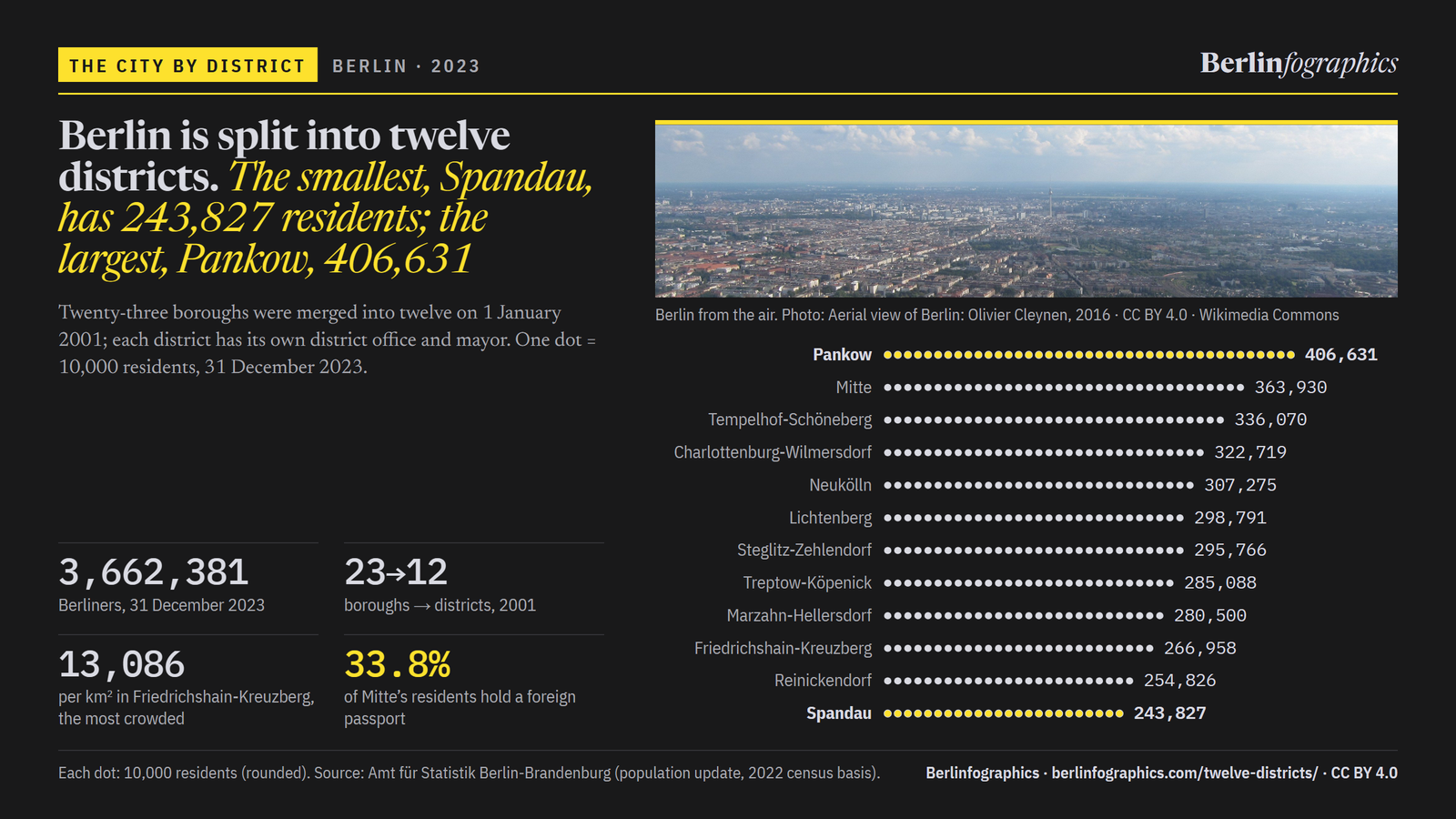
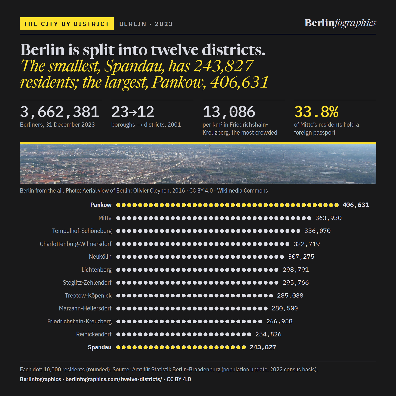
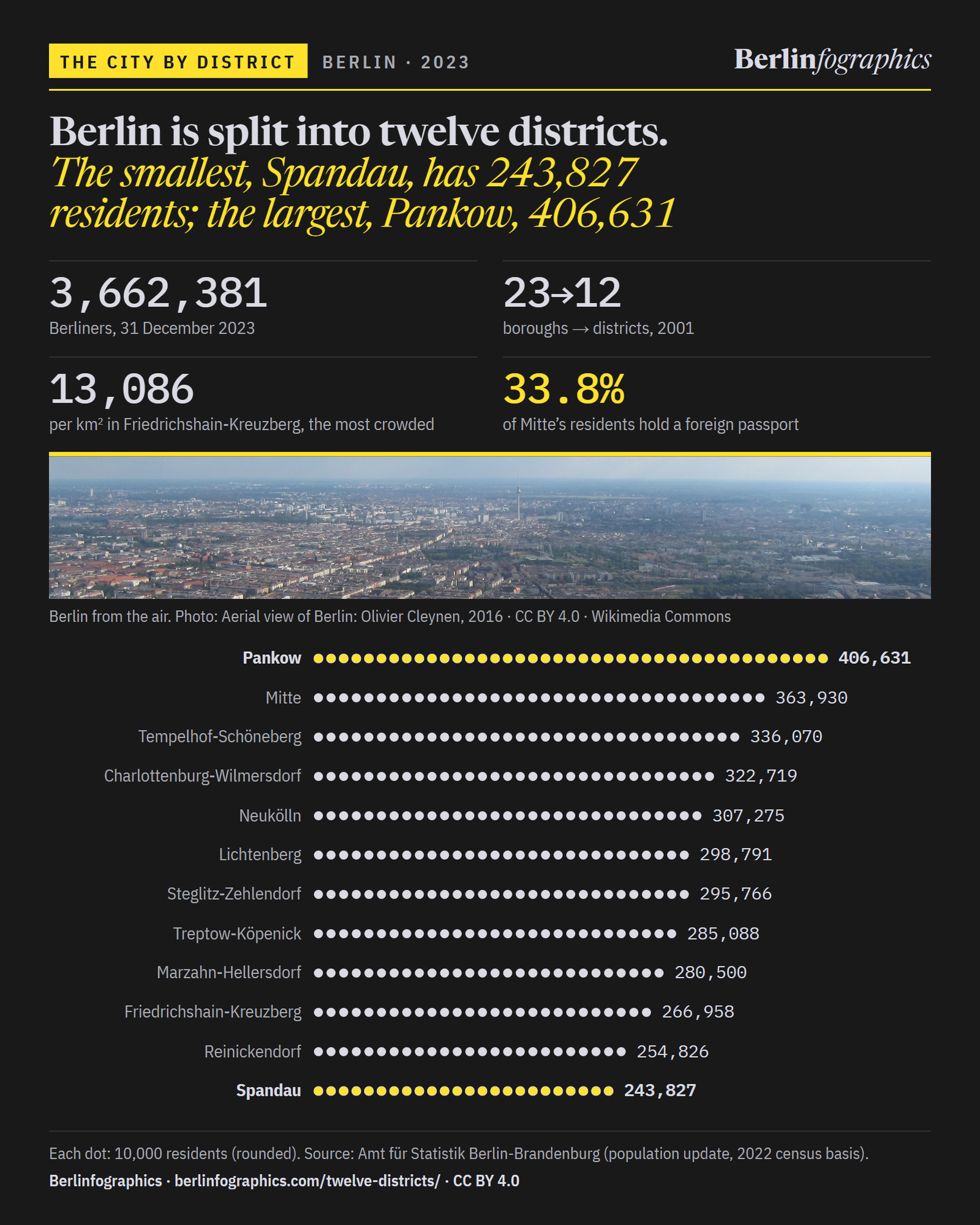
Berlin is split into twelve districts, each with its own mayor. The smallest, Spandau, has 243,827 residents; the largest, Pankow, 406,631

On 1 January 2001 the city folded its twenty-three boroughs into twelve. Here are the 3,662,381 people who lived in them on 31 December 2023, one dot for every 10,000, and what sets each district apart: the most crowded, the largest, the one where a third of the people hold a foreign passport, and the one on record since before Cölln.

Scroll through the city, dot by dot

Berlin from the air, 2016: rows of tenement blocks, parks and rail lines running out to the horizon, with the Fernsehturm rising in the centre.Aerial view of Berlin: Olivier Cleynen, 2016 · CC BY 4.0 · Wikimedia Commons
01Twelve districts, 3,662,381 people

Every district has more than 240,000 residents

Since 2001 Berlin has been governed in two tiers: the city, and twelve districts, each with its own district office, the Bezirksamt, and its own district mayor. The largest is home to one Berliner in nine.

12districtsBerlin
numbered 01–12
= 10,000 residentsMap: © OpenStreetMap contributors
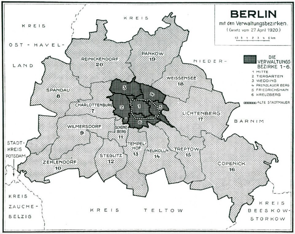
A printed map titled Berlin mit den Verwaltungsbezirken, the city divided into numbered districts with the six central ones shaded dark.
Berlin’s districts as drawn in 1920 (Paul Wittig, 1930).Paul Wittig, 1930. Wikimedia Commons. Public domain.

1 January 2001

Twenty-three boroughs became twelve districts

On 1 January 2001 Berlin’s twenty-three boroughs were merged into twelve districts. Each has its own district office, the Bezirksamt, and its own district mayor. They are numbered 01 to 12, from Mitte in the centre to Reinickendorf in the north.

Source: berlin.de · Berlinfographics fact-check

31 December 2023

3,662,381 Berliners, one dot for every 10,000

On the official count, the population update on the 2022 census basis, Berlin had 3,662,381 residents on 31 December 2023. Each dot here stands for 10,000 of them, scattered across the district where they live. Where the dots crowd, so do the people.

Source: Amt für Statistik Berlin-Brandenburg

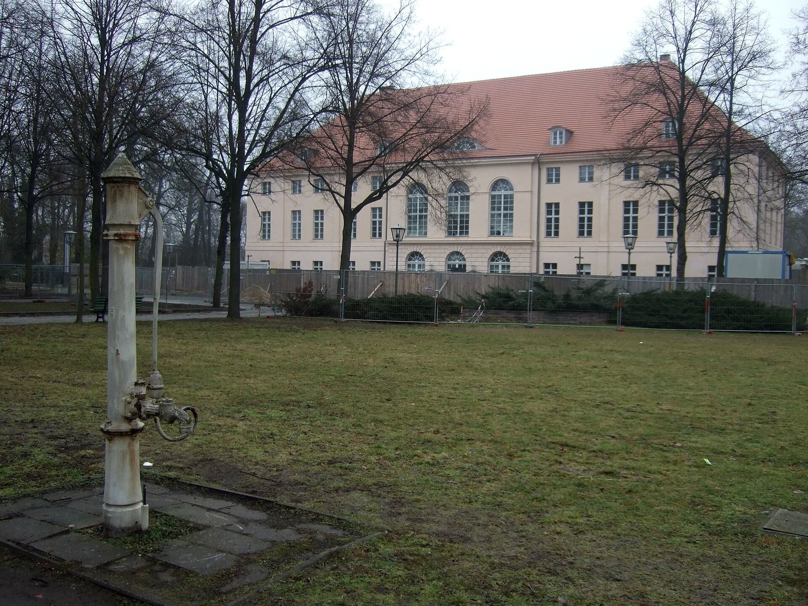
A pale two-storey palace with a red roof behind a lawn and bare winter trees, an old iron water pump in the foreground.
Schönhausen Palace, Pankow, 2009.Sebastian Wallroth, 2009. Wikimedia Commons. Public domain.

District 03

Pankow: one Berliner in nine

Pankow, district 03 in the north-east, is the largest by population: 406,631 residents, 11.1% of the city.

Source: Amt für Statistik Berlin-Brandenburg · Berlinfographics fact-check

A cobbled courtyard inside the Spandau Citadel, low yellow buildings and tall trees under a blue sky with clouds.
The Spandau Citadel, 2011.JoJan, 2011. Wikimedia Commons. CC BY 3.0.
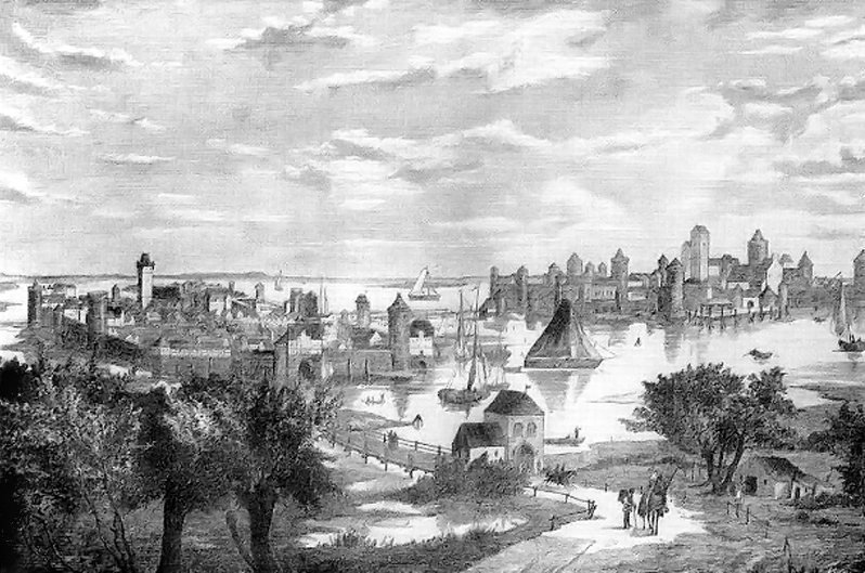
An engraving of a walled medieval town with towers and church spires beside a river, boats in the water and trees in the foreground.
Berlin and Cölln about 1250, imagined in 1882.F. Wittig, 1882. Wikimedia Commons. Public domain.

District 05

Spandau: the fewest people, on record since 1197

Spandau, in the west, has 243,827 residents, the fewest of the twelve; Pankow has 1.7 times as many. Spandau was first recorded in 1197, 40 years before Cölln, and has been part of Berlin since 1920.

Source: Amt für Statistik Berlin-Brandenburg · Bezirksamt Spandau · Berlinfographics fact-check

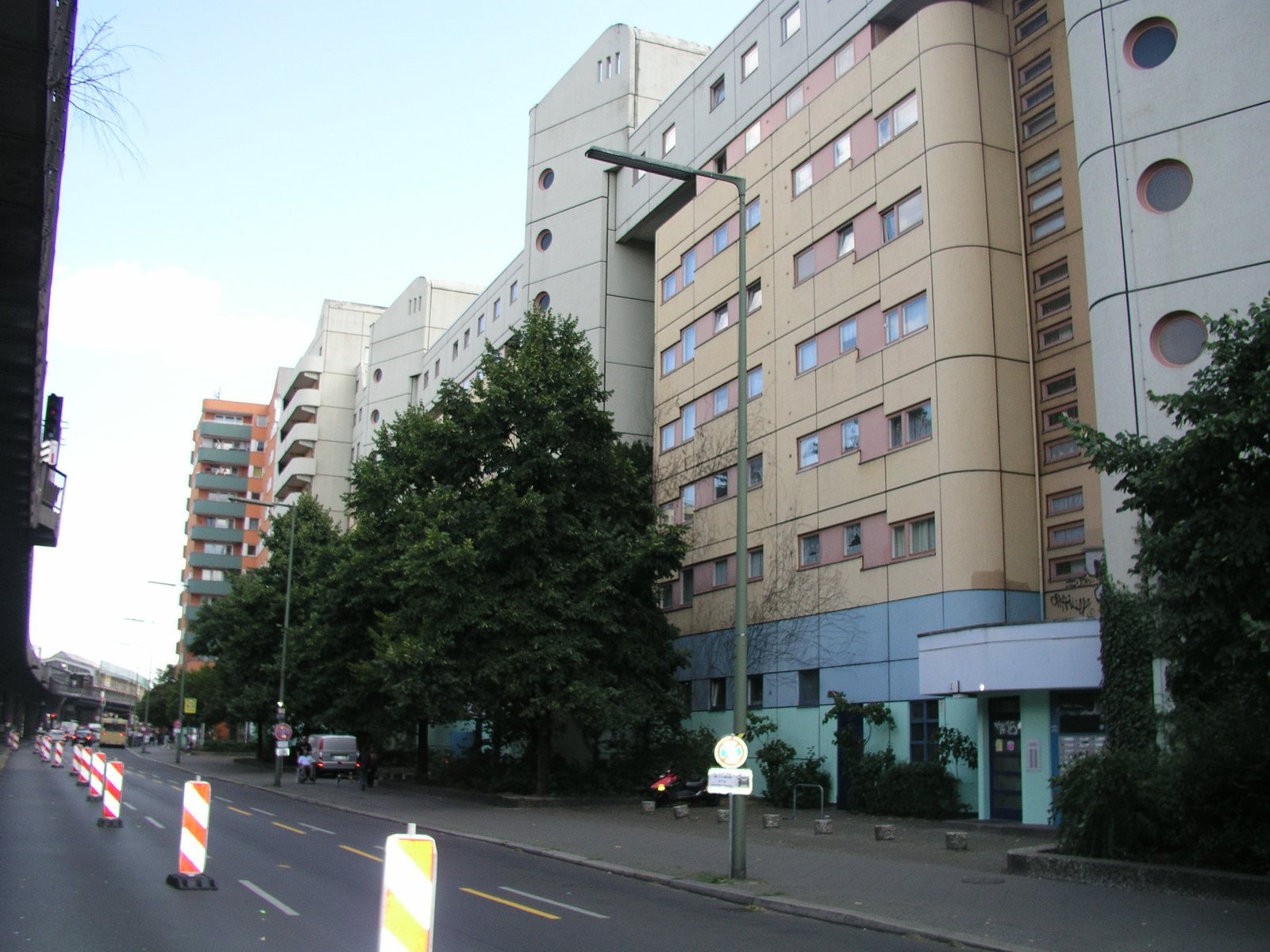
Tall cream and pale-green apartment blocks with round windows along a street with trees and red and white roadworks barriers.
Apartment blocks on the Kottbusser Platz, Kreuzberg, 2008.Angela Monika Arnold, Berlin, 2008. Wikimedia Commons. CC BY 3.0.

District 02

Friedrichshain-Kreuzberg: the smallest district, and the most crowded

About 20 km² of ground and 266,958 residents: 13,086 people to every square kilometre, the highest density in Berlin. Its dots pack tighter than anywhere else on the map.

Source: Amt für Statistik Berlin-Brandenburg · Amt für Statistik, 130/2025

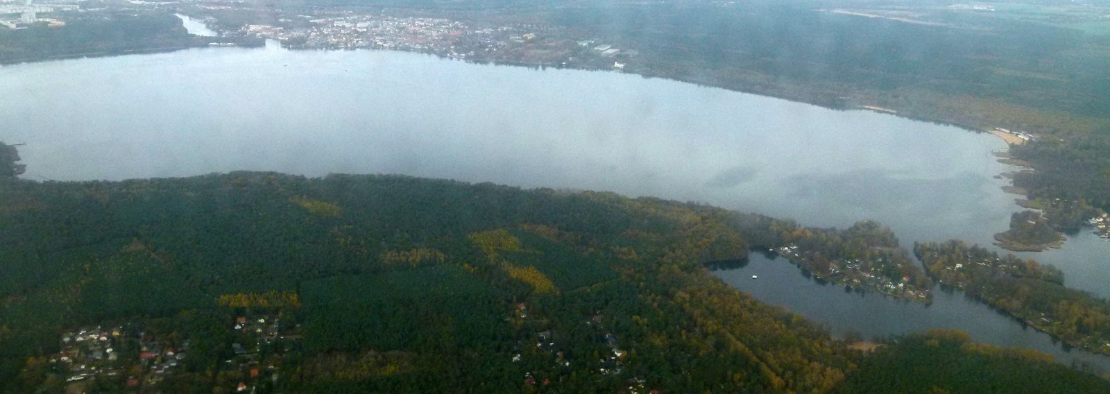
A wide lake seen from a height, ringed by dark forest, with a smaller lake and a channel in the foreground.
The Müggelsee, Treptow-Köpenick, 2012.Brücke-Osteuropa, 2012. Wikimedia Commons. CC0.

District 09

Treptow-Köpenick: more than eight times the land

The largest district by area, about 168 km² in the south-east, is more than eight times the size of Friedrichshain-Kreuzberg. Yet it has only 18,130 more residents: 285,088.

Source: Amt für Statistik, 130/2025 · Amt für Statistik Berlin-Brandenburg · Berlinfographics fact-check

The Berlin television tower, a slender concrete shaft with a silver sphere and a red and white antenna, against a clear blue sky above a rooftop.
The Fernsehturm, Mitte, 2011.Dietmar Rabich, 2011. Wikimedia Commons. CC BY-SA 4.0.

District 01

Mitte: one resident in three holds a foreign passport

122,980 of Mitte’s 363,930 residents are foreign nationals, 33.8%: the highest share of the twelve. On the map, twelve of its dots turn blue.

Source: Amt für Statistik Berlin-Brandenburg · Berlinfographics fact-check

The upper storeys of old apartment houses painted white, red, yellow and pink, with a street lamp against a deep blue sky.
The Karl-Marx-Straße, Neukölln, 2018.Neuköllner, 2018. Wikimedia Commons. CC BY-SA 4.0.

District 08

Neukölln: one in four

In Neukölln, 77,373 of 307,275 residents hold a foreign passport, 25.2%: eight blue dots.

Source: Amt für Statistik Berlin-Brandenburg · Berlinfographics fact-check

All of them

Lined up, from 406,631 down to 243,827

Ranked by residents, Pankow, Mitte, Tempelhof-Schöneberg lead; Friedrichshain-Kreuzberg, Reinickendorf, Spandau close the list. Between first and last lie 162,804 people.

Source: Amt für Statistik Berlin-Brandenburg · Berlinfographics fact-check

02Twelve shapes, one scale

Treptow-Köpenick has more than eight times the land of Friedrichshain-Kreuzberg, and barely more people

Here are the twelve districts side by side, each drawn at the same scale and filled with its own dots, largest population first. Friedrichshain-Kreuzberg, about 20 km², is a small, tight knot; Treptow-Köpenick, about 168 km², sprawls, its 285,088 residents spread thin.

Each dot: 10,000 residents, 31 December 2023. Outlines: © OpenStreetMap contributors.

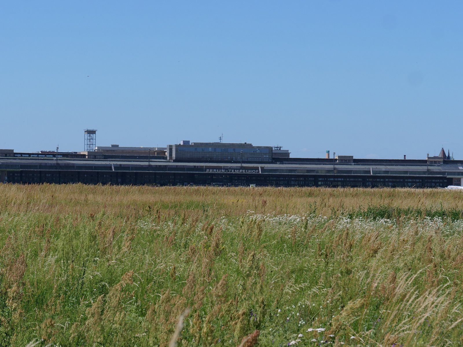
A wide meadow of tall summer grass under a pale blue sky, with the long low terminal building of Tempelhof Airport far away on the horizon.
Tempelhofer Feld in June 2019: long grass on the old airfield, with the terminal of the former Tempelhof Airport on the horizon.Leonhard Lenz, 2019. Wikimedia Commons. CC0.

03Twelve districts, twelve characters

An airfield, a zoo of 160 hectares, a closed airport and Germany's largest estate of prefabricated housing: the twelve by number

In the official order, 01 to 12. Each bar is the district’s population against Pankow’s.

Berlin · twelve districts

Cut Berlin into twelve and every piece has its own mayor and at least 243,827 people. The largest has two-thirds more.

Press & citation

Use this Berlinfographic

Free to publish under CC BY 4.0 — in print, online, on Wikipedia and in teaching, commercially or not — with credit to Berlinfographics and a link to this page.

Berlin, District by District: ready-to-use landscape image

Ready-to-use image

The infographic as one image: headline, key figures, chart, sources and credit, 2,400 × 1,350 px PNG. Please use it unedited.

Download landscape (PNG)
Berlin, District by District: square version

Square format

A 1:1 version for social media and narrow columns, 1,800 × 1,800 px.

Download square (PNG)
Berlin, District by District: portrait version

Portrait 4:5

For Instagram and LinkedIn feeds, 1,620 × 2,025 px.

Download portrait (PNG)

Credit line

Berlinfographics (berlinfographics.com), CC BY 4.0

Citation

Berlinfographics (2026). “Berlin, District by District”. Berlin Experiences. https://berlinfographics.com/twelve-districts/

Wikipedia

{{cite web |title=Berlin, District by District |url=https://berlinfographics.com/twelve-districts/ |website=Berlinfographics |publisher=Berlin Experiences |date=2026-11-06 |access-date=2026-11-06}}