Berlinfographicsby Berlin Experiences

Leipziger Platz and Potsdamer Platz from the air, about 1920: the dense old city that the Act surrounded with forests, lakes, villages and seven more towns.U.S. Army Air Forces photo 18-AA-170-45B, 1920. Wikimedia Commons. Public domain.

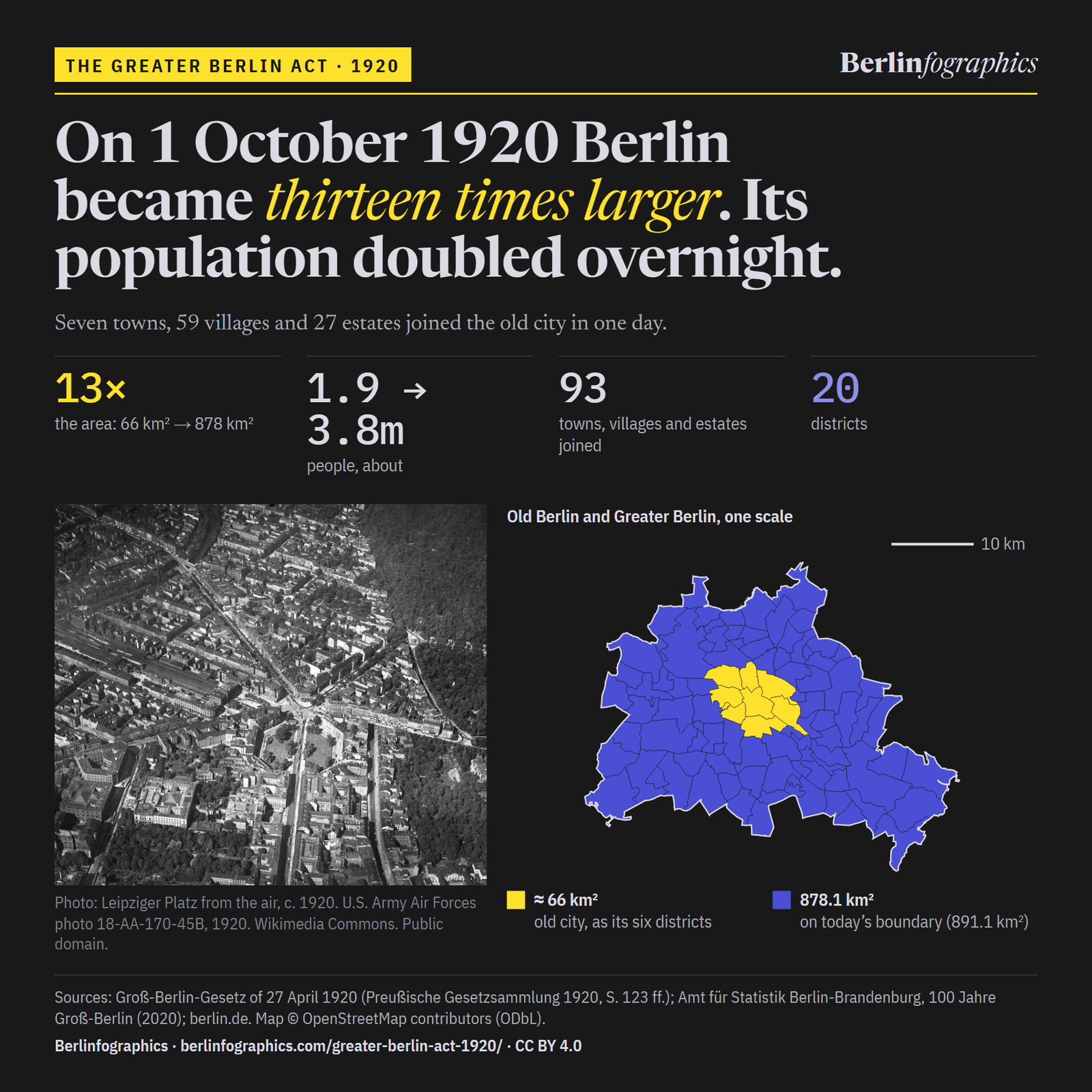
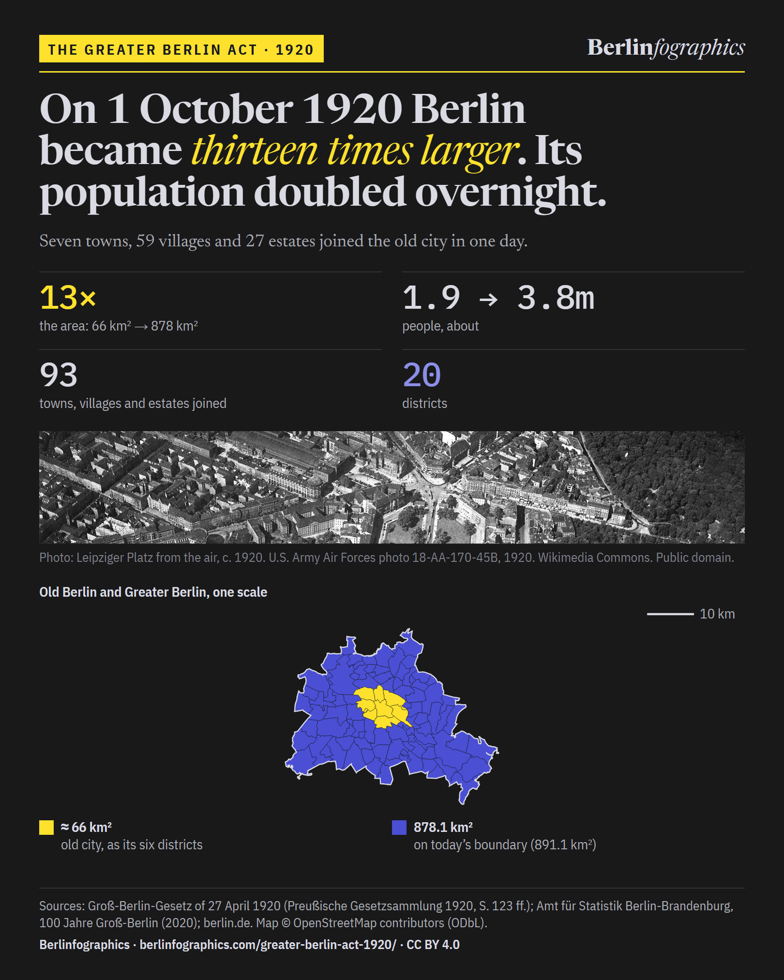
The Greater Berlin Act · 1920

On 1 October 1920 Berlin became thirteen times larger. Its population doubled overnight.

On 1 October 1920 a Prussian law joined seven towns, 59 rural communities and 27 estate districts to the old city. A city of about 66 km² and about 1.9 million people became one of 878.1 km² and about 3.8 million.

13×
the area: 66 km² → 878 km²
1.9 → 3.8m
people, about: the population doubled
93
places joined: 7 towns, 59 rural communities, 27 estates
20
districts, listed in the law’s Anlage II
01Before 1920

Berlin had outgrown its own limits

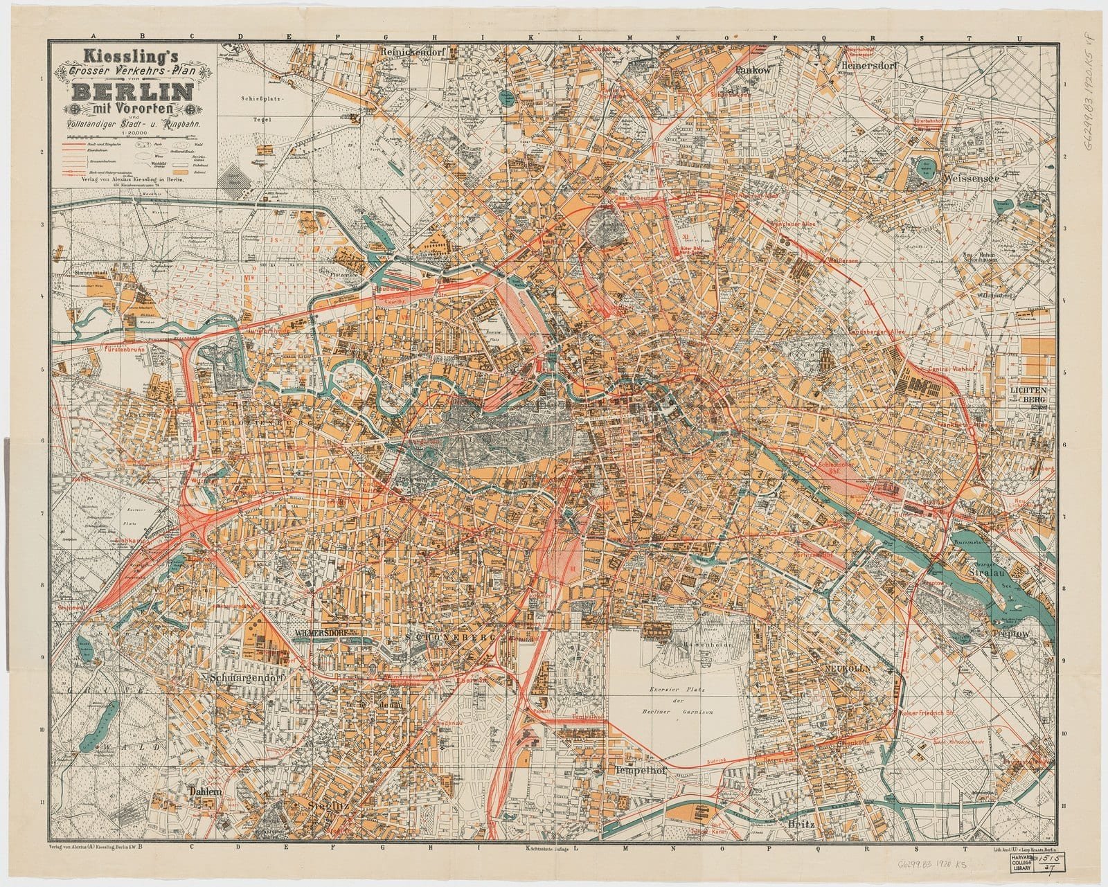
By 1920 the built-up city ran on, street after street, into Charlottenburg, Schöneberg and Neukölln: towns with their own town halls. Around 1900, by the count of the historian Herbert Schwenk, the 151 towns and municipalities of the Berlin area ran 43 gas companies, 17 water companies and 15 electricity companies side by side.

A first joint body, the Zweckverband Groß-Berlin, began work on 1 April 1912 to plan transport and buy up forests. Even so, in 1912 its area still had 16 separate tram companies.

One metropolis, many companies

Bars on one scale. Utilities around 1900, after Herbert Schwenk; tram companies in 1912. Source: berlin.de.

A colour city map of Berlin in 1920: a large orange mass of built-up streets with rail lines in red radiating to the suburbs, rivers and lakes in blue.
Kiessling’s Great Traffic Plan of Berlin with its suburbs, 18th edition, 1920. The built-up city, in orange, had long since run past its own limits into the towns around it.Unknown author, 1920. Wikimedia Commons. Public domain.

0227 April – 1 October 1920

One law redrew the map in a single day

The map is drawn from OpenStreetMap, on one projection and one scale. The yellow shape is the six inner districts that the old city became, on today’s lines. The outer line is the city limit set in 1920, drawn on today’s boundary (891.1 km², after some smaller exchanges since).

The old city, inside the limit to come

A map of Berlin drawn from OpenStreetMap: the six inner districts that grew out of the old city, inside the city limit set in 1920, with the seven towns and the villages and estates that joined it.
Old city (six inner districts)City limit of 1920

Map: © OpenStreetMap contributors (ODbL). Inner shape: the six inner districts on today’s Ortsteil lines, 71 km², a little more than the old city’s 65.72–65.9 km². Outer line: today’s boundary, 891.1 km²; the limit of 1920 enclosed 878.1 km².

Before 1 October 1920

A city of about 66 km²

The old city of Berlin covered 65.72 km² and held about 1.9 million people. Its built-up streets ran on, without a break, into towns and villages that governed themselves.

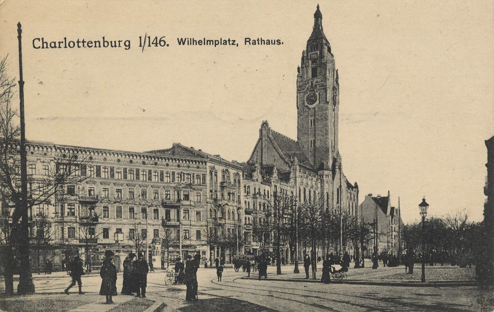
A sepia postcard of a long town hall with a tall tower, trees along the square and people walking in front. The printed title reads Charlottenburg, Wilhelmplatz, Rathaus.
Charlottenburg’s town hall, 1915.Unknown photographer, 1915. Wikimedia Commons. Public domain.

Seven towns

Seven towns with their own town halls

The law brought in seven towns: Charlottenburg, Cöpenick, Lichtenberg, Neukölln, Schöneberg, Spandau and Wilmersdorf. Its list counts eight, because Berlin itself comes first.

A colour city map of Berlin in 1920: a large orange mass of built-up streets with rail lines in red radiating to the suburbs, rivers and lakes in blue.
Kiessling’s plan of Berlin and its suburbs, 1920.Unknown author, 1920. Wikimedia Commons. Public domain.

Villages and estates

59 rural communities and 27 estate districts

Farming villages came in too, along with forest and palace estates. Eight names appear twice, once as a village and once as an estate. Some estates came only in part, such as the northern part of the Potsdam forest.

A black-and-white map of Greater Berlin divided into twenty numbered districts, the six central ones shaded dark, with the surrounding Kreise named at the edges.
The twenty districts of 1920, mapped by Paul Wittig.Paul Wittig, 1930. Wikimedia Commons. Public domain.

1 October 1920

878.1 km², 20 districts

On 1 October 1920 the law took effect. Berlin became one municipality of 878.1 km² and about 3.8 million people, separate from the Province of Brandenburg. It had 20 districts.

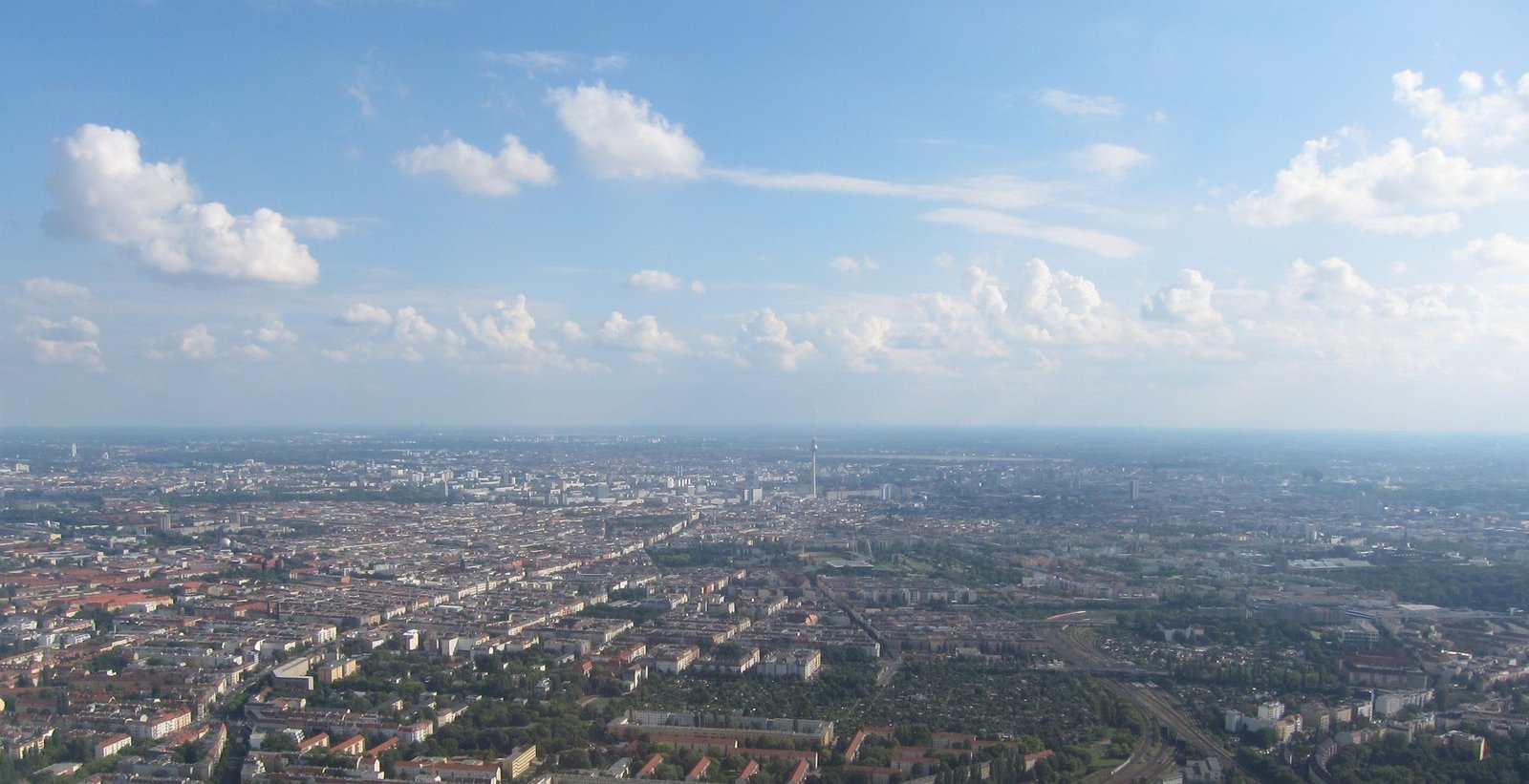
A wide aerial view across a city stretching to the horizon under a sky of white clouds.
Berlin from the air, 2016.Aerial view of Berlin: Olivier Cleynen, 2016 · CC BY 4.0 · Wikimedia Commons

1920 – today

The line still holds

Apart from some smaller boundary changes, Berlin still has the limits of 1920. Today it covers 891.1 km². Its districts were redrawn in 2001: see Twenty-Three into Twelve.

03Charlottenburg · Cöpenick · Lichtenberg · Neukölln · Schöneberg · Spandau · Wilmersdorf

Seven towns, each a city of its own

Each of the seven towns became a district of Greater Berlin and gave it its name. The 20 districts of 1920 were made from the six inner districts of the old city and from the towns, villages and estates around them.

A sepia postcard of a long town hall with a tall tower, trees along the square and people walking in front. The printed title reads Charlottenburg, Wilhelmplatz, Rathaus.

Charlottenburg

District 7 of 20, 1920

Charlottenburg’s town hall on Wilhelmplatz, today Richard-Wagner-Platz, on a postcard of 1915, when Charlottenburg was still a city of its own.Unknown photographer, 1915. Wikimedia Commons. Public domain.

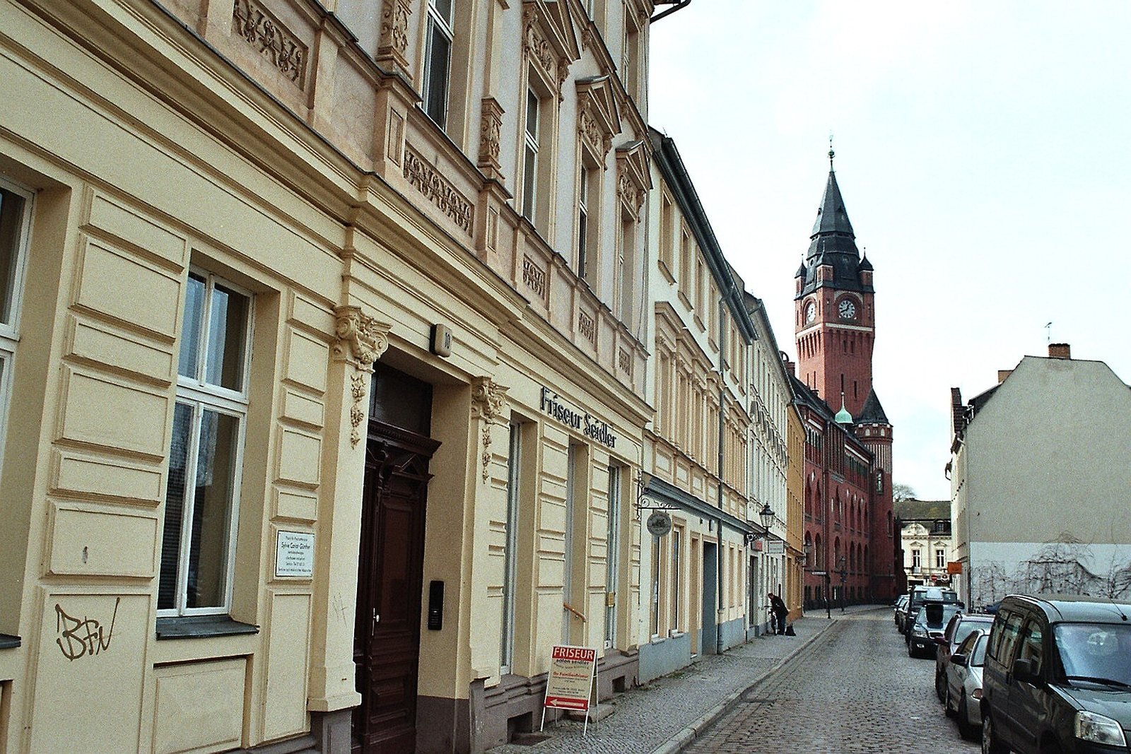
A narrow cobbled street of low pastel houses leading to a red-brick town hall tower.

Cöpenick

District 16 of 20, 1920

Köpenick, spelled Cöpenick in 1920: the Rosenstraße and the tower of the town hall, 2006.Dguendel, 2006. Wikimedia Commons. CC BY 4.0.

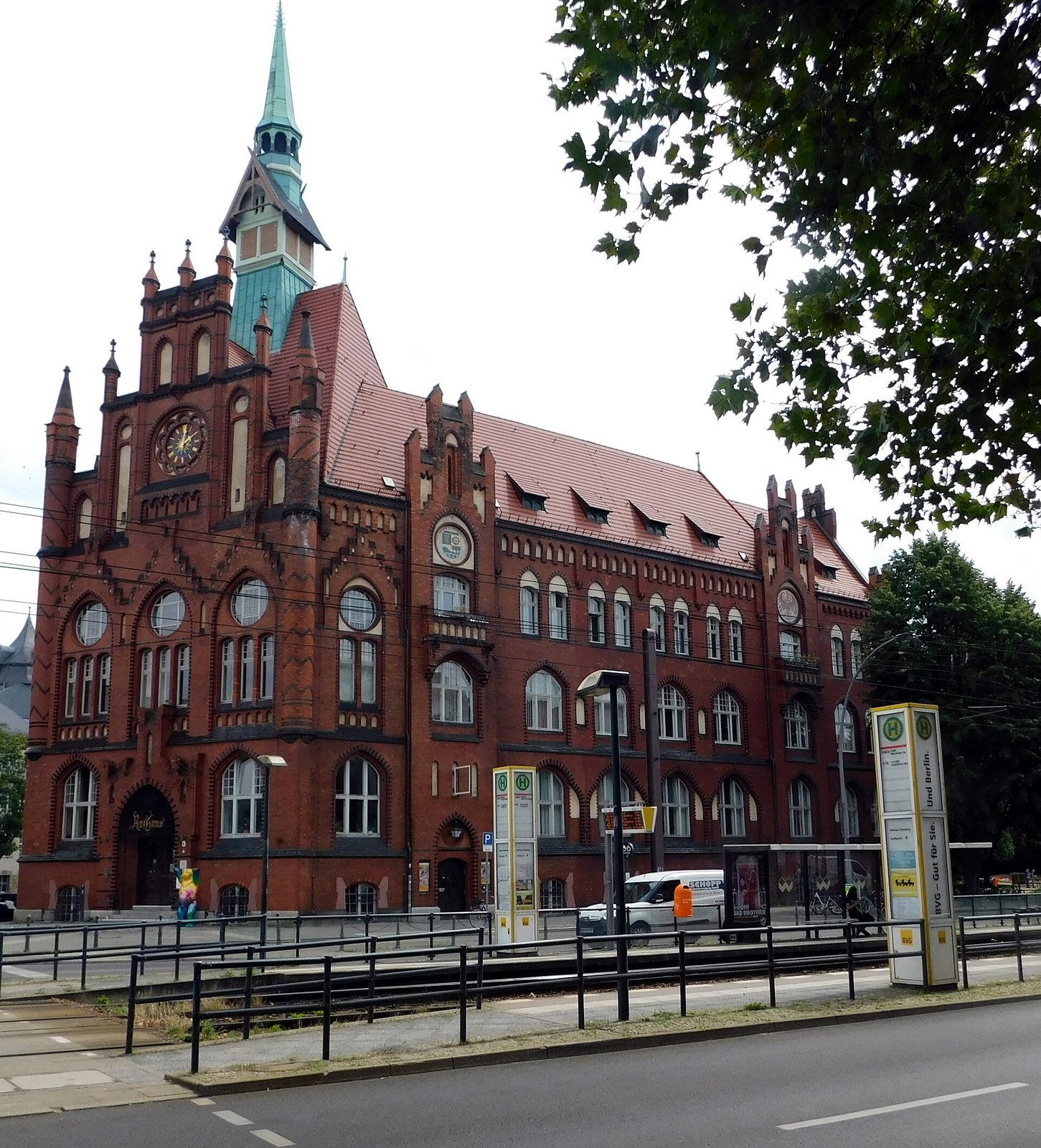
A red-brick town hall with gables and a green-copper spire, a tram stop in front.

Lichtenberg

District 17 of 20, 1920

The town hall of Lichtenberg, 2021.Sciureto, 2021. Wikimedia Commons. CC BY-SA 4.0.

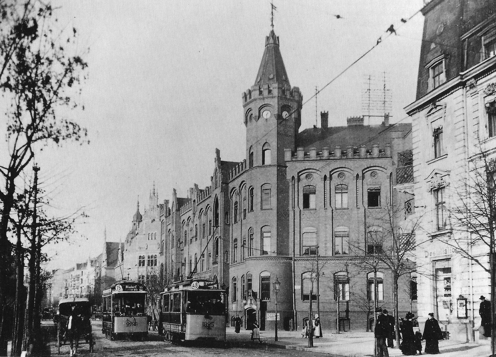
A black-and-white street scene with a turreted brick town hall, two trams in the street and pedestrians on the pavement.

Neukölln

District 14 of 20, 1920

The old town hall of Rixdorf, about 1905. The town was renamed Neukölln in 1912; the tram’s destination board still reads “Rixdorf”.Unknown author, 1905. Wikimedia Commons. Public domain.

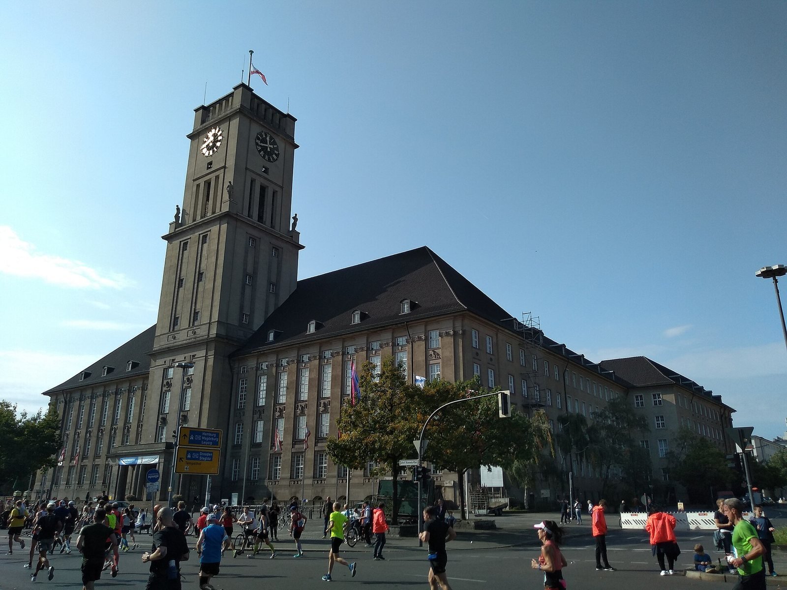
A large stone town hall with a square clock tower under a blue sky, runners passing on the road in front.

Schöneberg

District 11 of 20, 1920

The Rathaus Schöneberg and its tower, 2021.Lucas Werkmeister, 2021. Wikimedia Commons. CC BY 4.0.

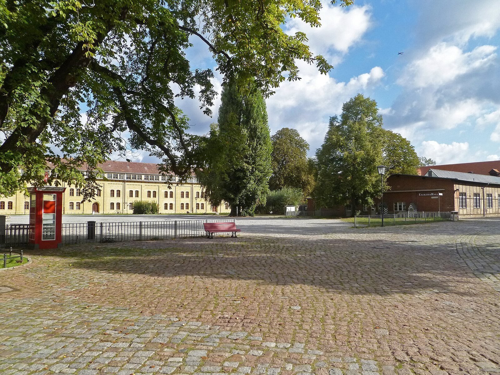
A cobbled courtyard inside a fortress, with long low yellow buildings and trees.

Spandau

District 8 of 20, 1920

The Spandau Citadel, 2011. Spandau was a town of its own until 1920.JoJan, 2011. Wikimedia Commons. CC BY 3.0.

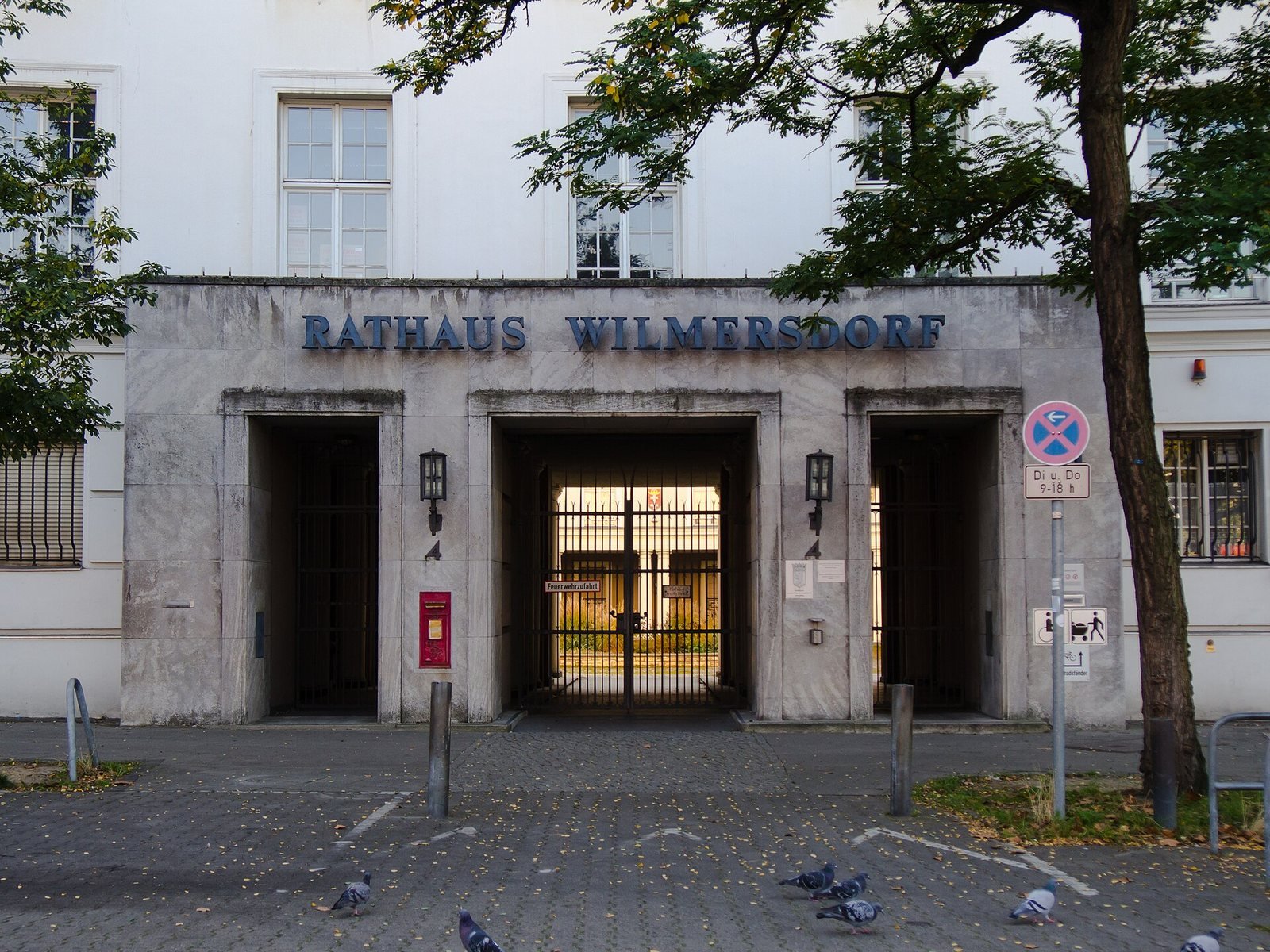
A pale stone entrance with three square openings and the words Rathaus Wilmersdorf above them.

Wilmersdorf

District 9 of 20, 1920

The entrance of the Rathaus Wilmersdorf, 2014.Sebastian Rittau, 2014. Wikimedia Commons. CC BY 4.0.

A black-and-white map of Greater Berlin divided into twenty numbered districts, the six central ones shaded dark, with the surrounding Kreise named at the edges.

The twenty districts

Mitte · Tiergarten · Wedding · Prenzlauer Tor · Friedrichshain · Hallesches Tor · Charlottenburg · Spandau · Wilmersdorf · Zehlendorf · Schöneberg · Steglitz · Tempelhof · Neukölln · Treptow · Cöpenick · Lichtenberg · Weißensee · Pankow · Reinickendorf

Prenzlauer Tor and Hallesches Tor were renamed Prenzlauer Berg and Kreuzberg in 1921. Map by Paul Wittig, 1930.Paul Wittig, 1930. Wikimedia Commons. Public domain.

0427 April 1920

A narrow vote in the Prussian assembly

Prussia’s constituent assembly, the Verfassunggebende Preußische Landesversammlung, passed the law on 27 April 1920, in its 139th sitting. The vote was 165 to 148, with five abstentions, according to the Abgeordnetenhaus. The city’s history page, berlin.de, gives 164 votes in favour.

Every vote cast, one dot per member

Yes 165The one vote in doubtNo 148Abstained 5

The Abgeordnetenhaus counts 313 members voting yes or no; berlin.de has one fewer yes vote. The ringed dot is that vote.

A black-and-white photograph of a large neo-Renaissance parliament building with a columned portico, on a wet street lined with bare trees.
The Prussian Abgeordnetenhaus on Prinz-Albrecht-Straße, about 1900. The constituent assembly passed the Greater Berlin Act here in its 139th sitting.Unknown author, 1900. Wikimedia Commons. Public domain.
An aerial view of a large pale stone building with a glass roof over its central hall, surrounded by modern office blocks.
The same building in 2013, today the seat of Berlin’s state parliament, the Abgeordnetenhaus.Arild Vågen, 2013. Wikimedia Commons. CC BY-SA 3.0.

05Land and people, to scale

Thirteen times the land, twice the people

The land grew thirteen-fold, the population only two-fold: Berlin took in far more space than people. The Province of Brandenburg lost 2% of its area to Greater Berlin, and 44% of its people.

Area, km²

One linear scale. Old Berlin: 65.72 km² (berlin.de); the Amt für Statistik gives 65.9 km². Today: Amt für Statistik Berlin-Brandenburg.

People, millions

Rounded, as the Amt für Statistik gives them. The year-end counts were 1,928,432 (31 Dec 1919) and 3,879,409 (31 Dec 1920): see Berlin’s population, 1871–2024.

The 93 places that joined, one square each

■ 7 towns · ■ 59 rural communities · ■ 27 estate districts. Section 1 of the law numbers 94, because Berlin itself heads the list of towns.

By the city’s own account, Greater Berlin was second only to Los Angeles in area. In people it was the third city in the world, after London and New York.

The area ranking comes from the city’s history page, berlin.de. The population ranking is the Amt für Statistik’s. In all, the city gained about 812 km².

A law passed by a margin of sixteen or seventeen votes drew the city that Berliners still live in.

Apart from some smaller changes, the line of 1 October 1920 is still Berlin’s boundary.

Press & citation

Use this Berlinfographic

Free to publish under CC BY 4.0 — in print, online, on Wikipedia and in teaching, commercially or not — with credit to Berlinfographics and a link to this page.

Greater Berlin, 1920: ready-to-use landscape image

Ready-to-use image

The infographic as one image: headline, key figures, chart, sources and credit, 2,400 × 1,350 px PNG. Please use it unedited.

Download landscape (PNG)
Greater Berlin, 1920: square version

Square format

A 1:1 version for social media and narrow columns, 1,800 × 1,800 px.

Download square (PNG)
Greater Berlin, 1920: portrait version

Portrait 4:5

For Instagram and LinkedIn feeds, 1,620 × 2,025 px.

Download portrait (PNG)

Credit line

Berlinfographics (berlinfographics.com), CC BY 4.0

Citation

Berlinfographics (2026). “Greater Berlin, 1920”. Berlin Experiences. https://berlinfographics.com/greater-berlin-act-1920/

Wikipedia

{{cite web |title=Greater Berlin, 1920 |url=https://berlinfographics.com/greater-berlin-act-1920/ |website=Berlinfographics |publisher=Berlin Experiences |date=2026-11-09 |access-date=2026-11-09}}